
Your cart is currently empty!
Himalayan Glacier Collapse Unleashes Deadly Floods Across Nepal
High in the Himalayas, a huge section of glacier broke away and crashed down a mountainside. What followed was a devastating chain reaction of ice, rock, mud and water that tore through valleys along the Nepal-China border, killing hundreds and leaving many more missing.
Contents
show
Scientists are still investigating exactly why the glacier collapsed. But satellite imagery and preliminary analysis have revealed how a disaster that began thousands of metres above sea level became a catastrophic flood that swept through communities far downstream.
The Collapse That Triggered a Catastrophe
The disaster began near Langtang Lirung, a towering peak in the Himalayas near the border between Nepal and China’s Tibet region. Satellite imagery taken before and after the event showed that a substantial part of a glacier had disappeared from the mountainside.
Scientists believe the lower section of the glacier broke off at an altitude of roughly 5,200 metres and crashed onto the valley floor around 1,200 metres below. The force of that collapse was so powerful that it generated seismic energy initially reported as an earthquake.
Nepali officials first considered the possibility that an earthquake had triggered a landslide. The U.S. Geological Survey later said the seismic event was generated by the collapse of glacial ice and rock, followed by the movement of debris.
The event registered at a magnitude of 5.2, illustrating the enormous force involved when a large mass of ice and rock suddenly breaks away from a steep mountain slope.
Vikram Gupta, an engineering geology specialist at India’s Sikkim University, said satellite imagery confirmed that a significant portion of the glacier’s snout had collapsed. The failure appears to have carried substantial amounts of rock and sediment with it, creating a far more destructive event than a simple ice fall.
Daniel Shugar, a geomorphologist and associate professor at the University of Calgary, reached a similar conclusion after examining satellite imagery from the area. His analysis suggested that the glacier’s lower section broke away before plunging down the steep terrain below.
What happened next turned a high-altitude collapse into a disaster that spread across an entire river system.
Ice and Rock Became a Violent Debris Flow
After the glacier collapsed, the enormous mass of ice and rock moved into the surrounding mountain valleys. Scientists and disaster officials believe an ice-rock avalanche entered the Lhende Khola, a tributary connected to the Bhote Koshi and Trishuli river systems.
The movement of debris created a cascading sequence of hazards. Ice, rock, sediment and water combined as they travelled downhill, increasing the destructive power of the flow as it moved through the steep Himalayan landscape.
Chinese government geologist Guo Zhaocheng said the ice-avalanche debris flow travelled at approximately 50 metres per second and extended for more than 20 kilometres. At that speed, communities and people caught in its path would have had almost no time to respond.
The geography of the region made the situation even more dangerous. Langtang Lirung sits among extremely steep valleys that can channel enormous volumes of material into narrow routes, increasing the speed and force of anything moving downhill.
Professor Mike Searle of Oxford University said the sequence may have involved more than one process. He suggested that a landslide could have blocked a river, allowing water to build up before the temporary barrier failed and released a massive flood.
“The sheer wave of debris suggests there could have been a landslide first; the water built up, dammed the river, and then it burst in one huge great flood,” Searle told the BBC.
Scientists are still working to establish the exact timeline. Searle said the sequence from the initial collapse to the full-scale flood may have unfolded over hours or even days, demonstrating how a mountain disaster can continue developing long after the first slope fails.
Rivers Rose Nine Metres Within Half an Hour
The floodwaters did not remain close to the site of the glacier collapse. The International Centre for Integrated Mountain Development, known as ICIMOD, said the disaster sent a powerful surge of water, sediment and large boulders through the Bhote Koshi and Trishuli river systems.
Monitoring information from downstream locations revealed the extraordinary speed at which the disaster unfolded. Water levels near Galchhi reportedly rose by between seven and nine metres within just 30 minutes.
Several monitoring stations were washed away or damaged, making it harder for authorities to understand conditions as the flood moved through the region. The destruction continued downstream for more than 100 kilometres, with the floodwaters changing river channels as they travelled from the high Himalayas toward lower areas of Nepal.
The dramatic difference in elevation helped drive the flow. The route from the glacier to affected downstream areas involved a descent of more than 4,500 metres, giving water and debris enormous momentum as they rushed through valleys.
This was not a typical flood caused by a river gradually overflowing after heavy rain. The surge carried thick mud, rocks, sediment and other debris with destructive force, sweeping away infrastructure and inundating settlements in areas far from the original glacier collapse.
Some of the first major structures hit were immigration and customs facilities near the Nepal-Tibet border. Surveillance footage captured a huge brown mudflow surging through the canyon as people attempted to escape from the approaching disaster.
Satellite analysis carried out after the flooding showed that many buildings near the path of the debris flow had been engulfed. Roads, bridges and power infrastructure were also damaged or destroyed, making rescue operations far more difficult.
Communities Were Destroyed and Survivors Were Left Searching
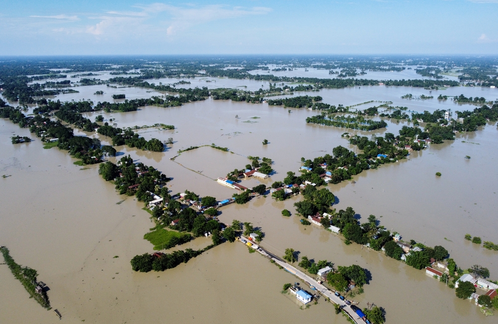
The human toll from the disaster has been immense. Rescue workers continued searching through debris-covered valleys and hillsides as authorities tried to determine how many people had been killed or swept away.
The casualty figures varied across the reference reports as the situation continued to develop. Hundreds were reported dead, while large numbers of people remained missing as rescue teams struggled to reach communities cut off by damaged roads and bridges.
The Red Cross said entire villages had been destroyed and warned that the full scale of the disaster remained unclear. In the mountainous terrain of northern Nepal, access can be difficult even under normal circumstances, and the flood severely damaged many of the routes needed to reach isolated communities.
One survivor, 68-year-old Keshav Prasad Baral, described the moment the mudflow approached his home. He said he saw an enormous surge of mud moving directly toward the area, growing higher as it came closer.
“It was a huge gush of mud coming straight towards us,” Baral said while receiving treatment in a Nepali hospital.
He said he tried to grab his wife’s hand and take her to the terrace when the mud entered their home, but she was swept away by the flow.
The disaster also affected the mountainous district of Rasuwa, where several hydropower projects are located. Mountain rivers provide enormous potential for electricity generation because of their steep gradients and powerful currents, but infrastructure built along these valleys can be highly exposed when a sudden landslide or debris flow occurs.
For many residents, the danger came from far above them. A collapse that began near a remote glacier quickly travelled through connected valleys and river systems, bringing destruction to communities that may never have seen the original event.
Scientists Are Still Investigating Why the Glacier Failed
The precise cause of the glacier collapse has not yet been confirmed. Scientists examining satellite imagery have identified several factors that may require further investigation, but no single explanation has been established.
Daniel Shugar said satellite images appeared to show substantial snow melt in the 24 hours before the disaster. Some glaciers in the valley that appeared snow-covered in earlier imagery looked mostly like bare ice after the event.
He said this could suggest warm conditions in the area, although he also stressed that weather station data would be needed to understand what role temperature may have played.
Construction has also been mentioned as a potential factor that may require investigation. Shugar said scientists would likely examine whether human activity contributed to conditions surrounding the collapse.
There are also powerful geological forces constantly reshaping the Himalayas. Professor Searle explained that the mountain range continues to rise because of tectonic movement, as the Earth’s plates push against one another and force the landscape upward.
As mountains rise, slopes can become steeper and glaciers can sit in increasingly unstable positions. Smaller ice falls and collapses occur naturally in high mountain environments, but Searle said the apparent scale of this event was highly unusual.
He told the BBC that floods and glacier-related events occur regularly in the Himalayas, but this disaster appeared to involve a much larger collapse than is normally seen.
The preliminary evidence has led scientists to consider a combination of processes. Long-term tectonic activity may shape and steepen the mountains, while environmental changes can alter the stability of the ice and frozen ground covering them.
Climate Change Is Increasing Pressure on Himalayan Mountains

Scientists have warned against claiming that climate change was the sole immediate trigger for this particular glacier collapse. Establishing a direct link between global warming and a single event requires detailed scientific investigation.
The wider environmental picture, however, has become increasingly concerning. Experts say rising temperatures can create conditions that destabilise glaciers, mountain slopes and the frozen ground that helps support them.
Dr Simon Cook, a glacier expert at the University of Dundee, said a warming climate can lead to shrinking glaciers, increased snow melt and the thawing of permafrost.
Permafrost is ground that remains frozen for long periods. In high mountain environments, it can help bind together rock and other material on steep slopes.
Professor Andrew Mackintosh, a glaciologist at Monash University, described mountain permafrost as being similar to glue that helps hold rock and sometimes nearby glaciers together. As temperatures rise and that frozen ground degrades, some slopes may become less stable.
Scientists have high confidence that climate change is contributing to glacier retreat around the world. The connection between warming and individual large glacier collapses is harder to measure because major events of this kind are comparatively rare.
Simon Cox, chief scientist at the Mountains to Sea programme at Earth Sciences New Zealand, said climate change is generating conditions that can destabilise high-mountain ice and rock. He pointed to increased melting, changing freeze and thaw patterns and the weakening of mountain slopes.
Several environmental changes are placing additional pressure on the Himalayas:
- Rising temperatures are accelerating glacier melt across the region.
- Thawing permafrost can weaken rock and ice on steep slopes.
- Increased meltwater can change the flow of mountain rivers and lakes.
- Shifting patterns of rainfall and freezing can destabilise fragile terrain.
- Retreating glaciers can leave behind lakes held back by natural barriers.
Each process carries different risks, but they can also interact. A changing glacier can affect the stability of a slope, while a landslide can block a river and create a temporary lake that later bursts.
This creates a dangerous chain of potential disasters in regions where communities and infrastructure sit directly below some of the world’s highest mountains.
Nepal’s Glaciers Are Already Retreating Rapidly

The disaster comes as researchers continue to document major losses of ice across Nepal and the wider Hindu Kush Himalaya.
The United Nations said in 2023 that Nepal’s mountains had lost close to one-third of their ice in just over 30 years because of global warming.
The same body reported that glaciers in Nepal had melted 65% faster during the previous decade than they had in the decade before it. Another analysis from ICIMOD found that glaciers across the Hindu Kush Himalaya are now losing ice at double the rate seen since 2000.
These figures describe a transformation taking place across one of the world’s most important mountain systems. The Himalayas provide water to vast river networks and support communities across several countries.
The immediate effects of glacier melt can include greater volumes of water moving through rivers and the formation of new lakes. Over longer periods, the continued loss of ice can alter water supplies and reshape entire mountain ecosystems.
Mohd Farooq Azam, a specialist with ICIMOD, said the growing frequency of hazards involving the Earth’s frozen environments is becoming increasingly visible.
“The pace of change is so rapid,” he said.
The risks are not limited to one type of disaster. Glaciers can collapse, mountain slopes can fail and glacial lakes can burst when natural barriers are breached.
The changing climate does not create every individual event on its own, but scientists increasingly see a pattern of environmental instability developing across high mountain regions.
Other Himalayan Disasters Have Shown Similar Dangers
The latest catastrophe is part of a wider history of deadly glacier and landslide disasters across the Himalayas.
In 2021, a huge mass of rock and glacier ice collapsed in the Chamoli region of northern India. The resulting cascade of debris and water killed around 200 people or left them missing.
Scientists later concluded that the avalanche transformed into an exceptionally large and mobile debris flow. Research estimated that the force of the impact released energy comparable to multiple atomic bombs.
Nepal has also experienced destructive floods connected to glacial lakes. In the same broader region, flooding last year was caused by a glacial lake in Tibet bursting.
Glacial lake outburst floods involve a different process from a glacier collapse, but they are linked to the same rapidly changing mountain environment. As glaciers retreat, meltwater can collect behind natural dams made of rock, ice or sediment.
If those barriers fail, enormous volumes of water can be released with little warning. According to the United Nations, Nepal has more than 2,000 glacial lakes, and 21 are considered potentially dangerous.
More than 12,000 deaths worldwide have been attributed to glacial lake outburst floods. The danger facing mountain communities is therefore broader than any single glacier or river.
A collapse can create a debris dam. A debris dam can block a river. Water can then accumulate behind that blockage before escaping downstream with destructive force.
The disaster near the Nepal-China border demonstrated how quickly these hazards can connect.
Fresh Flooding Risks Remain After the Collapse
The immediate danger did not end when the first floodwaters passed through the valleys.
Nepal and China warned of additional flooding risks after two lakes reportedly developed on opposite sides of the border. Authorities feared that the newly formed lakes could burst and send further surges of water into an already devastated region.
This secondary threat shows why mountain disasters can remain dangerous long after the original collapse. A major avalanche can fundamentally change the landscape, blocking rivers, redirecting water and creating temporary reservoirs behind unstable barriers.
Emergency workers therefore face a constantly changing environment. The first challenge is finding survivors and reaching isolated communities, but officials must also monitor the altered river systems for signs of further failures.
Scientists will continue examining satellite imagery, terrain data and environmental conditions to determine how the collapse happened. Their findings could prove important for understanding similar risks elsewhere in the Himalayas.
The region contains remote valleys where monitoring can be difficult and where warning times may be extremely short. Improving the ability to detect sudden changes in glaciers, lakes and mountain slopes remains a major challenge for governments and disaster agencies.
A Disaster That Started Far Above the Valley
The collapse near Langtang Lirung showed how a failure in a remote part of the Himalayas can become a catastrophe for communities far downstream. Ice broke away high on a mountain, rock and sediment joined the moving mass, and the landscape funnelled the resulting debris and water into connected river systems.
The exact trigger remains uncertain, and scientists will need more evidence before assigning responsibility to any single cause. What is already visible, however, is the increasing instability of a region where glaciers are retreating, frozen ground is warming and communities remain exposed to sudden mountain hazards.
For the people living beneath these towering peaks, environmental change is no longer visible only in satellite images and scientific reports. When the mountains fail, the consequences can arrive in the valley within minutes.