
Your cart is currently empty!
Tsunami of Dirt: Nepal’s Deadly Flood Began With a Mountain Giving Way
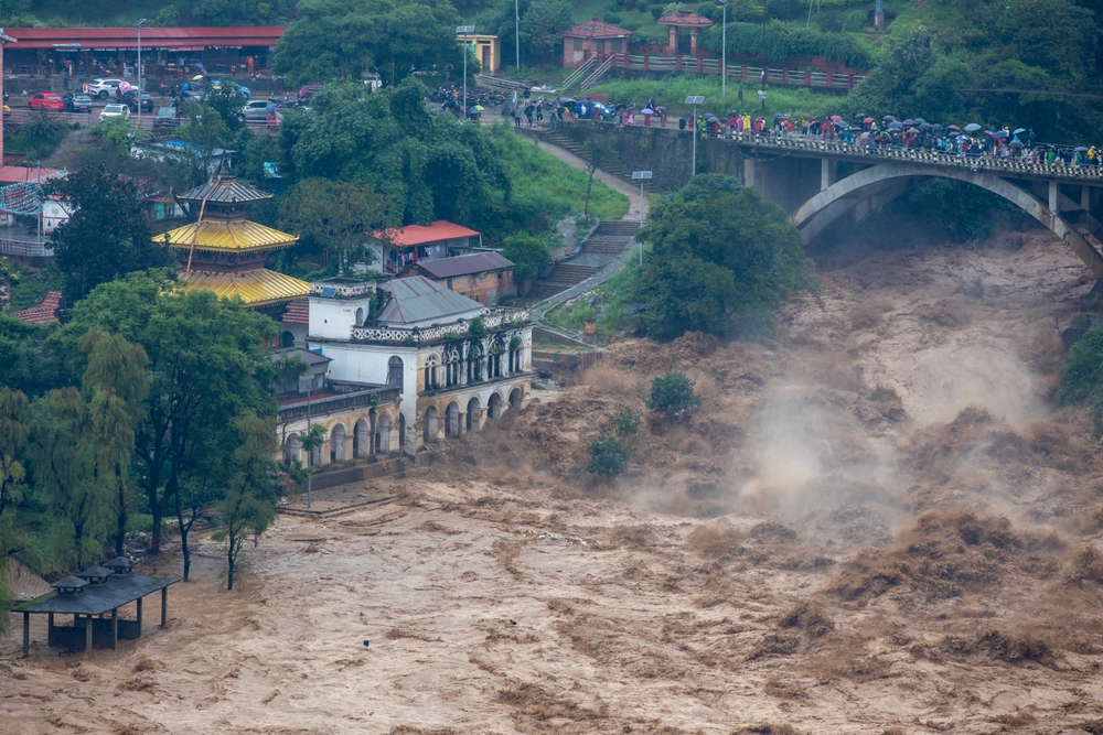
Rajendra Dawadi had roughly 900 students under his care when a mountain high above Nepal suddenly began to collapse. Within minutes, a massive mixture of ice, rock, mud, boulders and trees was racing toward communities below, transforming a remote Himalayan slope into the source of a devastating flood. Dawadi had spent years teaching inside Tribhuvan Trishuli Secondary School in Bidur, a building where he had once been a student himself. On August 26, 2026, that same school became one of the places directly threatened by the rushing disaster.
Contents
show
Dawadi did not know exactly what was coming, but he knew the danger was moving quickly. He rang the school bell, ordered students toward higher ground and told a bus carrying children to turn around. Upstream, homes, bridges and villages were already being swept away, while the river below was rising at a speed that left little time for decisions. The survival of hundreds of children came down to recognizing the warning signs and acting before the flood reached the school.
A Mountain Collapse Sent A Wall Of Debris Downstream
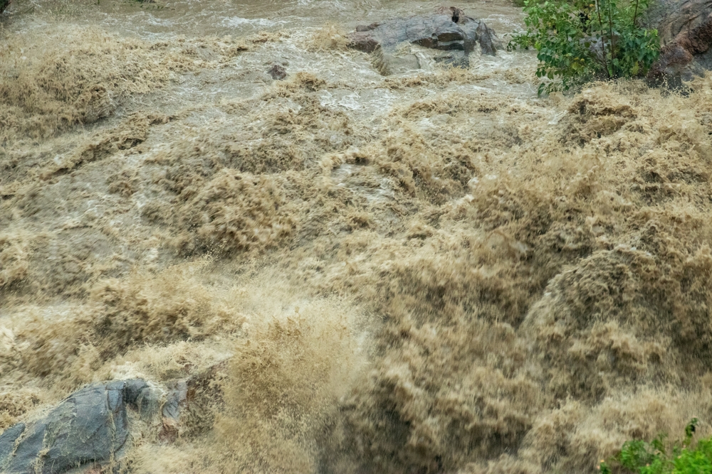
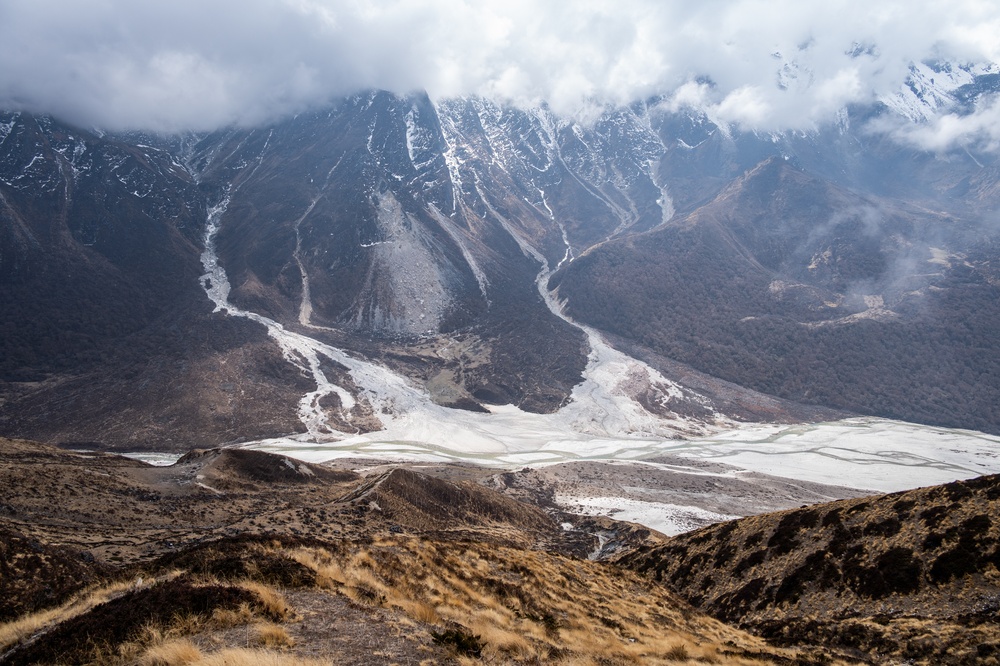
At 8:37 a.m. on August 26, a huge slab of ice and rock broke away from Langtang Lirung at an elevation of roughly 5,200 metres. Geoscientist Dan Shugar estimated that the mass then fell around 1,200 metres toward the valley below. Researchers examining satellite imagery said the event appeared to involve an avalanche of rock and ice, with the underlying bedrock slope failing first and the glacier sitting above it being carried down with the collapse. The resulting material was a huge moving mixture of ice, mud, trees, boulders and fractured rock.
The debris slammed into the Lhende Khola and blocked the river, creating a temporary natural dam that held back a huge volume of water. That barrier eventually failed, releasing the accumulated water and debris into the valley and sending the surge more than 170 kilometres downstream through the Bhote Koshi valley. By the time the flood reached Gyirong Port near the China border, the mass of water and debris was estimated to have formed a wall around 30 metres high. The sheer force of the event was enough to register on seismic instruments, initially producing what appeared to be an earthquake signal before researchers determined that the energy came from the massive landslide.
The event was initially logged as a magnitude 4.4 earthquake before the reading was revised to magnitude 5.2 after the source of the seismic energy was identified. That detail illustrates just how violent the mountain collapse was. The disaster also created confusion over the type of flood involved, because the event was closely associated with glaciers but did not follow the familiar pattern of a glacial lake outburst flood. The lake itself was created by the collapse that morning, meaning the mountain effectively built the hazard before releasing it.
The Flood Rose Nine Metres In Just 30 Minutes
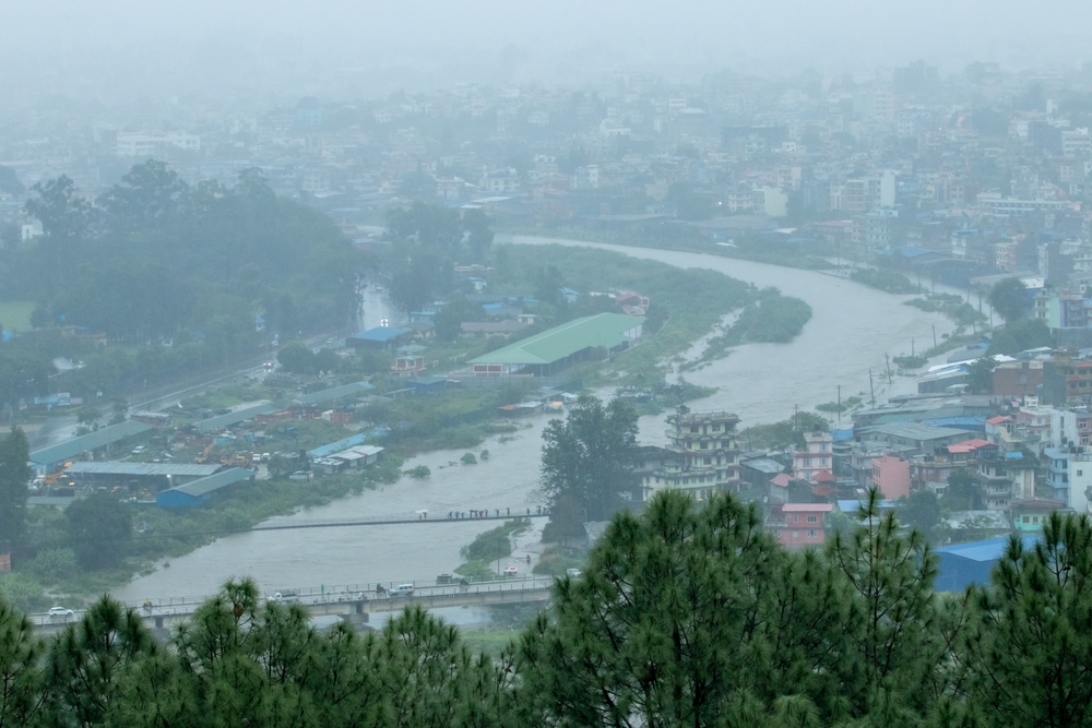
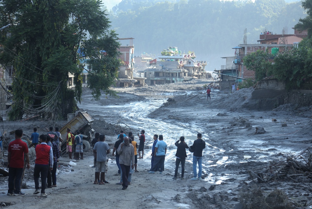
Downstream, the scale of the surge became terrifyingly clear as the Trishuli River rose around nine metres in only half an hour. That kind of increase can overwhelm communities before people have enough time to gather belongings, move vehicles or reach safer ground. Teacher Manoj Mishra described seeing around nine trucks swept away by the flood, with people caught in the disaster. The river was no longer behaving like a normal waterway. It had become the channel carrying the force of an enormous mountain collapse.
Businessman Raju Bhadel received a call that morning from a relative whose liquor store had stood beside the river. The relative and his family were crying as they reported that their entire house had been swept away. Such accounts showed how quickly the disaster moved from something happening high in the mountains to an immediate threat for people living and working along the valley. Houses, businesses, vehicles and bridges that had been part of everyday life were suddenly exposed to a wall of water and debris.
Nepal’s emergency warning system did send out a mass alert. At 9:15 a.m., around 679,000 messages were delivered within a single minute, warning people about the danger downstream. The problem was the timing. The messages arrived 38 minutes after the mountain collapsed, and for communities closest to the river, that delay left an extremely narrow window to escape. Disaster-risk specialist Saswata Sanyal said, “We don’t have hours. We have sometimes a few minutes to actually prepare.”
The Destruction Spread Across Nepal And Tibet
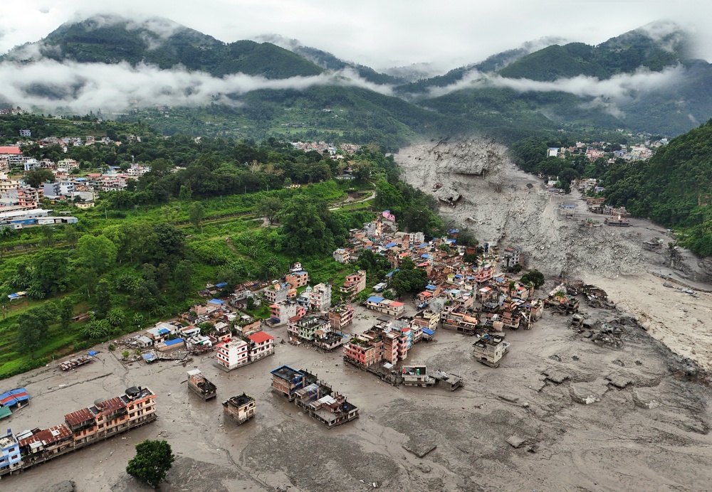
The human toll continued climbing during the days after the disaster as rescue teams reached communities that had been cut off or badly damaged. By September 2, Nepal’s National Disaster Risk Reduction and Management Authority had recorded 1,114 deaths and 3,916 people missing. Nearly 12,000 people had been rescued, while more than 21,000 police, soldiers and armed police were deployed during the emergency response. Authorities in Tibet also reported 16 deaths and 546 people missing as the destructive flood crossed the border region.
The damage extended far beyond the immediate loss of life. Forty-eight suspension bridges were damaged across the affected area, with 28 considered beyond repair. Thirteen hydropower projects were also hit, removing around 431 megawatts from Nepal’s national electricity grid. For mountain communities that rely heavily on bridges, roads and river infrastructure, the destruction created another problem after the water receded: reaching isolated communities and restoring basic services became much harder.
The scale of the flooding placed it among Nepal’s most devastating disasters in recent history. Basanta Raj Adhikari, who directs the Centre for Disaster Studies at Tribhuvan University, said he had not seen a flood event of comparable size during his research career in the Himalayan landscape. The disaster also showed how a single collapse high in the mountains can affect communities hundreds of kilometres away, with the initial failure setting off a chain of events that becomes increasingly difficult to control as the water moves downstream.
Warming May Have Increased The Risk, But Scientists Are Careful
Researchers had already observed unusual conditions around the mountain before the collapse. British Antarctic Survey researchers reported unusually high ground temperatures on the slope two days earlier, while satellite imagery from the preceding weeks showed movement in both the glacier and the rock beneath it. Those observations do not establish that warming caused the collapse, but they provide evidence that the slope was undergoing changes before it failed. In a region where enormous masses of ice and rock sit above populated valleys, even subtle changes can become serious concerns.
Permafrost is another part of the picture. Permanently frozen ground and rock can help stabilize steep mountain slopes, particularly where fractured rock contains ice that binds surfaces together. As temperatures rise and that frozen material begins to thaw, water can enter cracks and weaken the connections holding the rock in place. The Himalayan environment is already experiencing significant warming at high elevations, with glacierised areas above 4,000 metres warming considerably faster than the global mean.
The Langtang region has also experienced rapid glacier retreat compared with earlier decades. These changes form part of a broader transformation across the Hindu Kush Himalaya, where glaciers are losing ice and frozen ground is becoming increasingly vulnerable to warming temperatures. Researchers have linked rising temperatures to major changes across the region, although the precise cause of any individual landslide remains much harder to establish.
The Climate Connection Remains Unproven
Scientists have specifically warned against claiming that climate change directly triggered this particular collapse. Levan Tielidze, a glaciologist at Monash University, said it was “too early to say this was the exact cause.” Sanyal similarly urged caution about drawing a direct connection between warming and the August 26 collapse, while acknowledging that rising temperatures are changing the Hindu Kush Himalaya and affecting glaciers across the region.
That distinction is important because mountain disasters rarely have a single simple cause. Rock structure, rainfall, temperature, permafrost conditions, glacier movement and other geological factors can interact before a slope eventually fails. Climate change may be altering some of those conditions, but researchers need evidence specific to each collapse before assigning a direct trigger.
A New Lake Is Now Sitting Above The Wreckage
The first flood was only part of the danger. The debris left behind by the mountain collapse formed a new lake capable of holding between 1.5 million and 2 million cubic metres of water, while roughly another 3 million cubic metres were expected to drain into it. That leaves a huge amount of water sitting behind a natural barrier created from shattered mountain material. Unlike an engineered dam, the debris barrier was formed suddenly and has already been subjected to extreme forces.
The concern is what happens if that barrier fails. Pawan Bhattarai, an assistant professor of civil engineering at Tribhuvan University, warned that a sudden dam failure could produce another dangerous surge. The fractured bedrock and disturbed slopes above the lake add another layer of uncertainty because the mountain has already demonstrated that its structure can fail without giving downstream communities much time to react.
The situation has exposed three major risks that authorities and researchers must contend with:
- Sudden lake release: A failure of the debris barrier could send another powerful surge downstream toward communities already affected by the first flood.
- Unstable slopes: Rock surrounding the collapse zone has been fractured and disturbed, creating the possibility of additional movement.
- Limited monitoring: Only a fraction of Himalayan glaciers and high-altitude slopes are monitored closely enough to identify dangerous changes before a collapse occurs.
The original slope appears to have shown signs of movement before it failed, giving researchers clues that could become useful for future monitoring. The challenge is that much of the Himalayas is remote, difficult to access and enormous in scale. A warning system can only help if the dangerous change is detected early enough and the communities below have enough time to act.
One School Bell May Have Saved Hundreds Of Lives
When the flood reached Bidur, Tribhuvan Trishuli Secondary School was directly in its path. Dawadi had a personal connection to the building that went far beyond his job. He had been educated there, later spent his working life teaching there and watched generations of students pass through its classrooms. On the morning of the disaster, that history became secondary to the immediate need to get hundreds of children away from the river.
Dawadi sent the students uphill and ordered buses away from the danger zone. One bus carrying students had already reached the school when he instructed the driver to turn around. It crossed a newly constructed bridge shortly before the older bridge beside it collapsed. The timing was brutally close, but the decision gave the students a route away from the flood before the water and debris reached the school grounds.
The school itself did not survive. Mud, boulders and debris swept into the building, destroying a place that had served as both Dawadi’s former school and his workplace. Two members of staff remained missing after the disaster, but the roughly 900 students who had been at the school that morning survived.
Dawadi later described the loss in simple terms: “I got education from that school. And I gave education at that school.” Families returned after the evacuation to find the building destroyed, but many of them also found the man who had made the decision to move their children before it was too late.
The Himalayas Are Showing How Fast Disaster Can Move
The Nepal disaster shows the brutal speed at which a mountain collapse can become a regional emergency. A failure thousands of metres above the valley created a chain reaction involving a blocked river, a sudden flood and a surge that travelled deep into populated areas before many people had enough time to respond.
For the students at Dawadi’s school, the crucial warning was a bell and the decision of one teacher to act immediately. For others farther downstream, emergency alerts arrived only after the mountain had already collapsed. The difference between those two situations was measured in minutes.
The school can eventually be rebuilt, and damaged bridges can be replaced. The harder task is making sure the next warning reaches people before the mountain gives way, because in the Himalayas, the distance between a warning and disaster can be only a matter of minutes.