
Your cart is currently empty!
Noahs Ark Mystery Deepens After Researchers Discover Unusual Soil Samples

For decades, a strange boat-shaped formation near Mount Ararat in Turkey has kept the search for Noah’s Ark alive. Now, researchers have drilled more than 60 feet beneath the site, uncovering soil samples that have raised fresh questions about what could be hidden underground.
Contents
show
The team reports higher carbon levels inside the formation than in surrounding soil, alongside drilling results that did not reveal a continuous block of solid rock. Those findings have renewed interest in the site, although laboratory analysis is still needed before anyone can determine what the evidence actually means.
Researchers Have Dug Deeper Into The Noah’s Ark Mystery
The Durupınar formation in eastern Turkey has attracted attention since 1959, when its distinctive outline was identified in aerial photographs. Measuring approximately 157 metres long, the elongated feature resembles a large vessel when viewed from above, leading some researchers and biblical history enthusiasts to investigate whether it could be connected to Noah’s Ark.
The latest investigation has taken that search beneath the surface. The Noah’s Ark Research Project, working with university support, has collected more than 300 soil samples from locations inside and outside the formation. Some of the samples came from depths exceeding 60 feet, allowing researchers to examine material that earlier surface investigations could not reach.
According to project vice president Andrew Jones, the team used deep-core drilling during the latest field season to investigate the formation’s underlying structure. The work followed earlier sampling that had identified differences in soil composition between the interior and surrounding areas.
“When we drilled into the formation this year for the first time, we did not encounter any solid block of rock, of limestone [or] of any type of rock,” Jones told Fox News Digital. “We were hitting mainly soil.”
Jones said the results should encourage further examination of the formation rather than an immediate dismissal of the site as solid rock. However, the drilling observations do not independently establish that the feature was constructed by humans, and geologists still need to determine how its underground structure formed.
Higher Carbon Levels Have Raised Fresh Questions
One of the most closely watched aspects of the investigation involves differences in the material collected from inside and outside the formation. Researchers reported carbon levels roughly 40% higher in samples from the interior, raising the possibility that the soil contains a greater concentration of organic material.
Organic matter can include material originating from plants and other biological sources. The research team believes the difference could be consistent with decayed wood, potentially providing a reason to investigate the formation more closely.
However, carbon measurements alone cannot identify the source of the material. Higher concentrations do not prove that timber is present, establish the age of any organic matter or demonstrate that a wooden vessel once occupied the site.
The findings also follow an earlier round of sampling conducted in 2024. According to Jones, those samples contained three times more organic matter inside the formation, along with 38% more potassium and differences in pH levels compared with samples collected outside it.
Those results encouraged researchers to investigate deeper layers to see whether the differences continued underground. The newer samples are now undergoing laboratory analysis, which could help establish whether the unusual measurements reflect organic deposits, geological variation or another explanation.
Jones explained that the team wanted to test the samples for signs of human activity or material consistent with decayed wood. The results could help narrow down possible explanations, although the interpretation will depend on what laboratory testing establishes.
The distinction between an intriguing measurement and archaeological evidence remains central to the investigation. Until researchers identify the material and establish its origin, the higher carbon levels should be treated as a lead for further testing rather than evidence that Noah’s Ark has been found.
What Is The Strange Formation Near Mount Ararat?
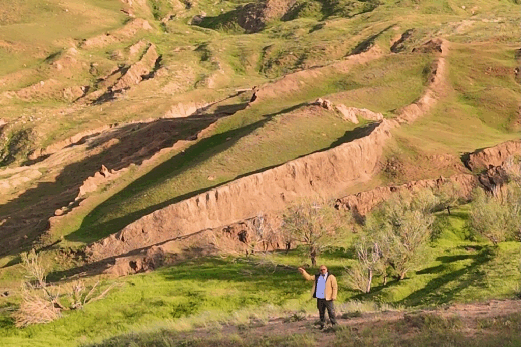
Image Credits – Instagram @Noahsarkscans
The Durupınar formation lies in Ağrı Province in eastern Turkey, close to Mount Ararat and the Iranian border. Its unusual outline has made it a recurring subject of speculation because it resembles the shape of a large boat when viewed from above.
The biblical account describes Noah building an enormous vessel to preserve his family and pairs of animals from a catastrophic flood. After the waters receded, the Ark came to rest in the “mountains of Ararat,” a reference that has inspired generations of searches for a possible physical location.
Some researchers believe the Turkish formation deserves further examination because of its dimensions and appearance. Others argue that the resemblance is insufficient to identify the feature as an ancient vessel, particularly when geological processes can create unusual landforms.
The formation’s length has encouraged comparisons with the dimensions of Noah’s Ark described in Genesis. However, translating the ancient unit of measurement known as the cubit into modern measurements involves uncertainty, and matching dimensions would not establish that a structure had a biblical origin.
The site first gained international attention after Turkish army captain İlhan Durupınar identified its outline in aerial photographs in 1959. Since then, the formation has attracted researchers, religious enthusiasts and sceptics seeking to understand whether its shape has a natural explanation.
Despite the continuing interest, no independently verified archaeological evidence has established that the Durupınar formation contains Noah’s Ark. Its unusual appearance remains the starting point of the investigation rather than a conclusion about its origins.
Why Geologists Have Challenged The Ark Theory
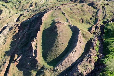
Image Credits – Instagram @Noahsarkscans
The idea that the formation represents a preserved wooden vessel has faced criticism from researchers who favour geological explanations. A study published in the Journal of Geoscience Education in 1996 examined claims surrounding the site and concluded that the formation was a naturally occurring rock structure.
Geologists have argued that natural processes can produce elongated formations and unusual patterns in the landscape. The movement of material around an obstruction, for example, can create features that resemble objects made by humans without requiring an archaeological explanation.
These earlier assessments are important because the latest drilling results must be considered alongside existing geological research. Finding soil rather than a continuous mass of solid rock at particular drilling points does not automatically rule out natural processes.
A formation can contain different layers of soil, sediment, boulders and rock without having been constructed as a vessel. Researchers therefore need to establish how the material is arranged and whether the observed features can be explained through natural geological development.
The latest investigation could contribute useful evidence to that debate by providing physical samples from documented locations and depths. Laboratory analysis may help scientists determine whether the interior and exterior materials differ in ways that can be explained by geology or suggest further archaeological examination.
The central question is whether the collected evidence supports a human-made structure more convincingly than existing natural explanations. That determination will require more than the formation’s appearance or a single unusual measurement.
Ancient Pottery Has Added Another Piece To The Puzzle
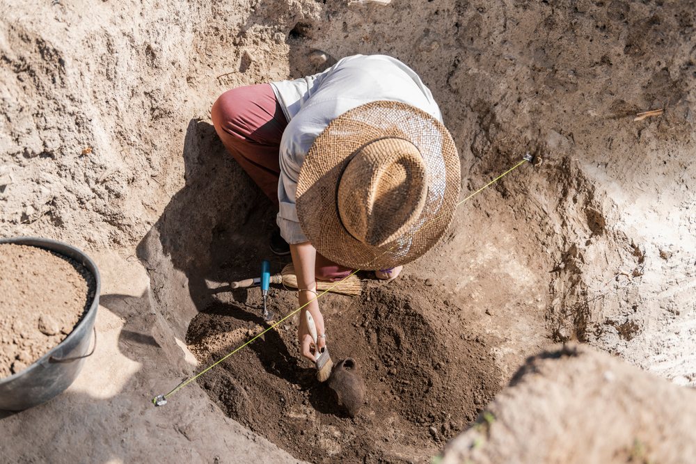
The investigation has also attracted attention because pottery fragments have been found near the formation. The objects have been tentatively associated with periods ranging from the early Chalcolithic, or Copper Age, through the Iron Age, based on their style.
Jones has clarified that the pottery was discovered beside the formation rather than inside it. That distinction matters because objects found nearby do not automatically establish the age or purpose of the geological feature itself.
The project vice president has pointed to two ancient settlements near the site as potentially relevant to understanding the area’s history. If future research establishes that the formation contains a human-made structure, archaeological investigations of the surrounding area could provide useful context.
“You can connect the dots,” Jones said. “If this is Noah’s Ark, we have people living right beside it early on.”
The statement reflects a possibility being considered by the research team, rather than a verified connection between the settlements and the biblical story. The nearby settlement mentioned by Jones has not been excavated, and the pottery has not been shown to belong to a structure within the formation.
Establishing a connection would require researchers to determine the age, origin and archaeological context of any relevant objects. Until that work is completed, the pottery remains evidence of possible past human activity in the surrounding area, not confirmation that Noah’s Ark rested there.
A 16th-Century Map Has Renewed Interest In Ararat
Another historical detail has recently drawn attention to the search. A world map created in 1587 by Italian cartographer Urbano Monte includes a small illustration of Noah’s Ark resting on the mountains of Ararat, the same broad region where researchers are investigating the Durupınar formation.
Monte’s enormous map was designed from a north polar perspective and consists of 60 hand-drawn sheets that can be assembled into a circular image measuring nearly 10 feet across. Its illustrations include ships, sea creatures and depictions of distant places, reflecting the geographical knowledge and traditions of the period.
The Ark illustration has attracted interest because it places the biblical vessel in the Ararat region centuries before the modern formation became a focus of investigation. Independent researcher Jimmy Corsetti highlighted the apparent similarity in location and length in an online post, prompting renewed discussion among people following the search.
The historical map offers evidence that the story of Noah’s Ark appeared in European cartography during the 16th century. It does not establish that Monte knew of the Durupınar formation or that the illustration represents a verified location of a historical vessel.
The map and the modern drilling project are separate sources of information. Any direct connection between the historical depiction and the geological feature would need supporting evidence rather than a resemblance in location.
What Would Researchers Need To Prove The Discovery?
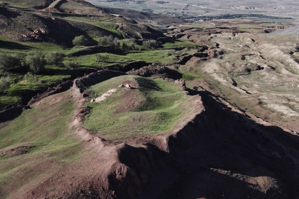
Image Credits – Instagram @Noahsarkscans
The current investigation could provide a clearer picture of what lies beneath the formation, but identifying Noah’s Ark would require several independent lines of evidence. Researchers would need to establish that the feature contains a constructed structure and that any associated material is consistent with the proposed historical interpretation.
Evidence of deliberate construction would be particularly important. Investigators would need to identify structural features that are difficult to explain through natural geological processes, with their conclusions supported by detailed examination and independent assessment.
If researchers eventually recover ancient wood or other organic material, dating would be essential. Establishing the material’s age and origin would help determine whether it belongs to an archaeological structure, represents natural deposits or was introduced into the area through another process.
The investigation also needs to establish how any artefacts relate to their surroundings. Objects found inside a formation may have different significance from those recovered nearby, especially when their original positions and associations are uncertain.
Several methods could contribute to a more reliable assessment:
- Laboratory testing: Researchers can analyse the collected samples to identify organic material and examine the differences between interior and exterior deposits.
- Reliable dating: Any potentially significant timber or other material would need appropriate dating to establish its age.
- Geological examination: Specialists must assess whether natural processes can explain the formation’s structure and underground features.
- Archaeological context: Investigators need to establish where artefacts originated and whether they are associated with a possible constructed structure.
- Independent verification: Other specialists should be able to examine the findings and evaluate whether the conclusions follow from the evidence.
Ground-penetrating radar and electrical resistivity measurements can help researchers investigate underground features without excavating every section of the site. However, unusual patterns in survey data do not automatically represent chambers, corridors or deliberately constructed spaces.
A specialised robotic device has also been discussed as a way to inspect accessible underground spaces and collect additional information. Its findings, like the drilling results, would need to be evaluated alongside geological and archaeological evidence.
The Search Continues As Laboratory Tests Take Centre Stage
The latest field season has provided researchers with physical samples from deeper beneath the Durupınar formation, giving the team new material to investigate. The results could help explain the differences reported in earlier sampling and establish whether the formation contains evidence that warrants further archaeological work.
For people who believe Noah’s Ark may have a physical resting place in Turkey, the investigation offers another opportunity to examine a long-standing question. For sceptics, the reported soil differences and drilling observations still need to be tested against established geological explanations.
Jones has acknowledged that the research remains unfinished and has encouraged people to follow the analysis rather than jump to conclusions. The team’s fieldwork has produced material for further study, but the central claim remains unverified.
The next important development will come from the laboratory results and the evidence researchers can independently confirm. Until then, the Durupınar formation remains an unusual site at the centre of a decades-old debate, with its origins still to be established.