Your cart is currently empty!
Lost Underwater Drone Captured Never-Before-Seen Formations Beneath Antarctic Ice
Somewhere beneath hundreds of meters of frozen Antarctic ice, a seven-meter robot lies silent in the dark. Its batteries died weeks ago. Its last known position remains a mystery. And the secrets it carried with it may never surface.
Contents
show
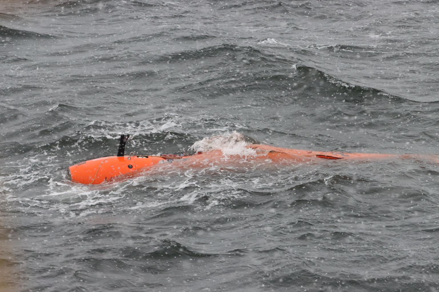
Ran was no ordinary underwater vehicle. Built by the University of Gothenburg and valued at 38 million Swedish kronor, it belonged to an elite class of autonomous submarines. Only three existed anywhere in the world. For five years, Ran had done what no human could do. It dove into the pitch-black waters beneath Antarctica’s glaciers, mapping terrain that had never been seen, measuring currents that had never been recorded, and capturing images of ice formations that scientists never knew existed.
In January 2024, Ran vanished during a routine mission beneath Thwaites Glacier in West Antarctica. Search teams deployed acoustic equipment, helicopters, and drones. None of it worked. Professor Anna Wåhlin, who led the expedition, could only watch as her prized research vehicle slipped away forever.
But before Ran disappeared, it sent back something extraordinary. Data from an earlier expedition revealed bizarre structures carved into the underside of Antarctica’s ice shelves. Shapes that looked like teardrops. Formations resembling dunes. Patterns that defied everything scientists thought they knew about how glaciers melt. And these discoveries may change how we predict the future of our planet’s rising seas.
First Eyes on a Hidden World
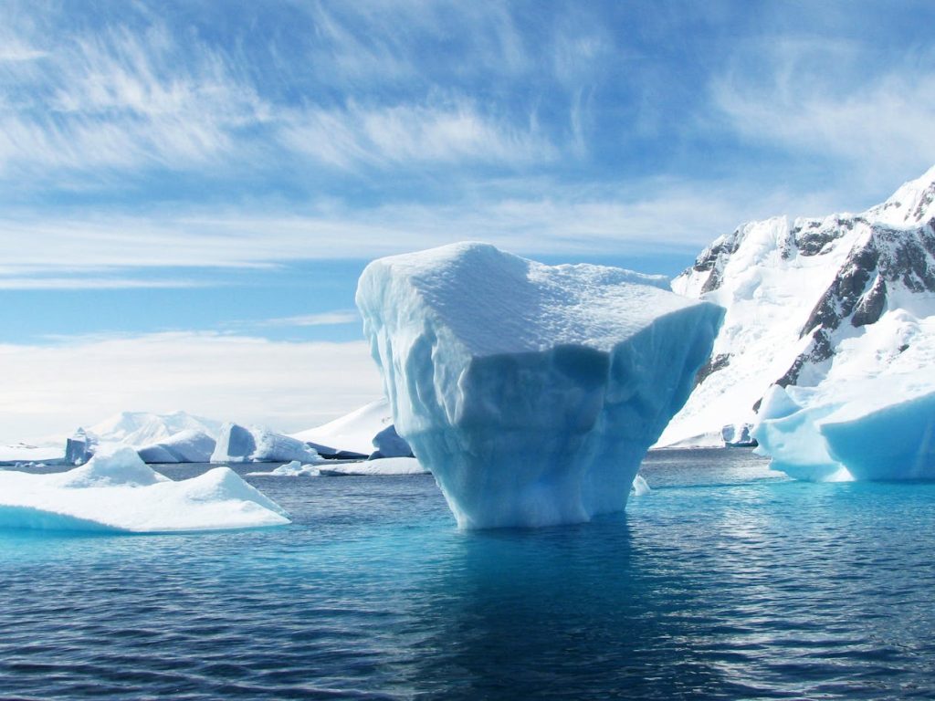
Two years before Ran’s disappearance, an international team sent the submarine on a different kind of mission. Instead of Thwaites, they targeted Dotson Ice Shelf in West Antarctica. A massive slab of floating ice seven times larger than New York City, Dotson sits on the coast of Marie Byrd Land and feeds into one of the most unstable ice sheets on Earth.
For 27 days, Ran traveled back and forth beneath the glacier. It covered more than 1,000 kilometers of underwater terrain, reaching 17 kilometers into a cavity hidden within the ice. An advanced sonar system scanned the frozen ceiling above, building up detailed maps of surfaces no human had ever glimpsed.
Before Ran, scientists relied on satellite images and ice cores to study how glaciers change. Satellites can show surface conditions from space, but they cannot see what happens beneath 350 meters of ice. Ice cores can reveal historical data frozen into the layers, but they cannot capture the forces acting on a glacier in real time.
Ran changed all of that.
“We have previously used satellite data and ice cores to observe how glaciers change over time,” Wåhlin explained. “By navigating the submersible into the cavity, we were able to get high resolution maps of the ice underside. It’s a bit like seeing the back of the moon.”
What Ran found beneath Dotson Ice Shelf surprised even the researchers who built it.
Strange Shapes Carved Into Ice

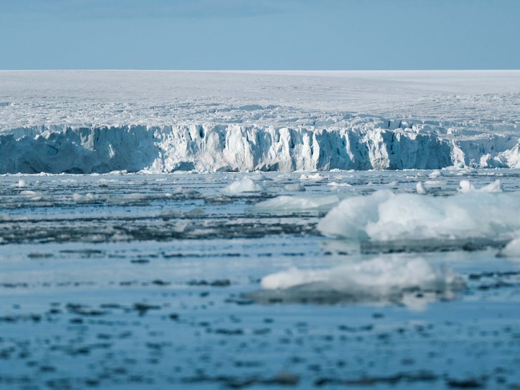
Scientists expected to find a smooth surface beneath the glacier. Ice, after all, tends to melt in predictable ways. Warm water rises, contacts the frozen ceiling, and slowly erodes it from below. Simple physics. Clean lines.
Ran’s sonar told a different story. Instead of smooth ice, the submarine discovered a wild landscape of peaks and valleys. Plateaus rose from the frozen surface. Deep channels cut through the ice base. And scattered across certain regions, bizarre teardrop-shaped indentations appeared in clusters.
Some of these formations stretched up to 400 meters long. Many reached depths of 50 meters into the ice. And almost all of them shared a strange characteristic. Rather than appearing symmetrical, the teardrops bent to one side, curving in ways that seemed to follow an invisible force.
Karen Alley, a glaciologist from the University of Manitoba who worked on the study, noted that researchers had suspected ice shelf bases might be complex. But Ran revealed patterns more extensive and complete than anyone had imagined. For the first time, scientists could compare what satellites showed on the surface with what actually existed beneath. And the two pictures did not match.
Many of the features Ran discovered never appeared on the glacier’s surface at all. Bridging stresses in the ice prevented full relaxation, meaning the intricate underwater landscape remained hidden from every satellite in orbit.
How Earth’s Spin Sculpts Glaciers
Understanding why the teardrops curved required thinking about forces that operate at planetary scales. Water moving across Earth’s surface does not travel in straight lines. A phenomenon called the Coriolis force, created by our planet’s rotation, pushes moving water to the right in the Northern Hemisphere and to the left in the Southern Hemisphere. Near the coast of Antarctica, this means ocean currents get deflected as they flow beneath the ice.
But something more complex happens near the ice-ocean boundary. Friction between the water and the frozen ceiling creates what scientists call an Ekman Spiral. Near the ice surface, water moves at an angle to the main current. Deeper layers move at different angles still, creating a spiral pattern that twists through the water column.
Wåhlin believed this spiral explained the teardrop shapes. “If you look closely at the shapes, they are not symmetrical, they are bent a bit like blue mussels, and the reason for that asymmetry is Earth’s rotation. Water moving on Earth is subject to something called the Coriolis force, which is acting to the left of the direction of motion in the Southern Hemisphere.”
When a disturbance occurs on the ice base, perhaps from a fracture tip or a large rock melting out of the glacier, it can trigger a plume of warmer water. Because of the Ekman layer, the plume spreads asymmetrically rather than fanning out in all directions. Near the source, the deflection is greatest. Further downstream, the plume grows and begins aligning more with the main current.
Over time, this creates the curved teardrop patterns Ran observed. Older formations showed tails that ran more parallel to the water flow, suggesting decades of gradual erosion had shaped their final form.
Fast Melt Zones and Hidden Fractures

Not all parts of Dotson Ice Shelf melt at the same rate. Ran’s data revealed dramatic differences between the glacier’s eastern and western regions.
In the west, strong underwater currents race beneath the ice at speeds up to 0.25 meters per second. These fast-moving waters create tremendous friction against the frozen ceiling, driving melt rates of around 15 meters per year. Here, the ice base appears smooth and eroded, scraped clean by the constant flow.
In the east and center, currents move far more slowly. Melt rates drop to just one meter per year, and the ice base looks completely different. Instead of smooth surfaces, researchers found terraced formations. Flat plateaus bounded by steep walls. Swirling patterns where slabs of ice had been removed from below.
Ran also revealed how fractures running through the entire thickness of the glacier accelerate melting. Warm, buoyant water accumulates inside these cracks, eating away at the ice from within. Older fractures showed significant widening and erosion compared to younger ones, suggesting decades of heat had worked on their surfaces.
Some fractures displayed strange oblique protuberances that scientists had never observed before. Their origin remains unknown, though they may result from stronger currents modified by Earth’s rotation or periodic flushing of warm water from inside the cracks.
A Return Trip Cut Short
Armed with data from the 2022 expedition, Wåhlin’s team returned to Antarctica in January 2024. Their goal was to repeat the surveys beneath Dotson Ice Shelf and document how conditions had changed over two years.
Ran completed one successful dive beneath Dotson before the team redirected it to Thwaites Glacier, sometimes called the Doomsday Glacier because of its potential to raise global sea levels by several meters. During missions, Ran operated without continuous contact with researchers. It followed pre-programmed routes, using an advanced navigation system to find its way back through the dark water. On its last planned dive, something went wrong.
After a long journey beneath 200 to 500 meters of ice, Ran failed to appear at its programmed meeting point. The South Korean icebreaker RV/IB Araon, which had been carrying the team, abandoned its homeward journey and launched a search. Acoustic equipment scanned the waters. Helicopters flew overhead. Drones surveyed the ice surface. Nothing worked.
“It’s a bit like looking for a needle in a haystack, but without even knowing where the haystack is,” Wåhlin said. “At this point, Ran’s batteries are dead. All we know is that something unexpected happened under the ice.”
Researchers suspect Ran encountered trouble somewhere beneath Thwaites and could not escape. What kind of trouble remains unknown? Perhaps a collision with unseen ice. Perhaps a navigation failure in the labyrinthine underwater terrain. Perhaps something stranger still.
Why Better Models Matter Now
Ran’s discoveries arrived at a critical moment for climate science. Current computer models that predict ice shelf melting cannot explain the complex patterns the submarine observed. Scientists had made assumptions about how glaciers erode from below, but those assumptions fell short when confronted with real data. Terraces, teardrops, and fracture networks all point to processes that existing simulations fail to capture.
West Antarctica’s ice sheet contains enough frozen water to raise global sea levels by approximately 3.4 meters if it collapsed. Warm ocean water already nibbles at the fringes of ice shelves like Dotson, unpinning them from the land and making their eventual collapse inevitable, according to previous studies.
Understanding exactly how fast this will happen requires understanding the forces at work beneath the ice. And that requires more missions like the ones Ran completed before it vanished.
Looking Ahead Through Loss
Wåhlin views Ran’s disappearance with a mix of grief and acceptance. Her team had known from the beginning that sending a robot beneath Antarctic glaciers carried real risks. In five years and roughly ten expeditions, Ran had already beaten the odds.
She noted that vanishing during active research was a better end than having the submarine age and gathering dust in a garage. Ran died doing what it was built to do, pushing into unknown territory and sending back information that no other instrument could provide.
Now her team plans to find funding to replace Ran and continue exploring beneath Antarctic ice. Peripheral equipment, trained personnel, and years of accumulated knowledge remain intact. What they need is a new vehicle capable of going where Ran went.
Because if Antarctica’s ice sheet enters the ocean at high rates, the consequences will reach every coastline on Earth. Learning the upper and lower limits of how fast this can happen may determine how cities, nations, and entire populations prepare for what comes next.
Somewhere beneath Thwaites Glacier, a silent robot holds answers that may never surface. But above the ice, scientists continue the work Ran started, piecing together a picture of our planet’s frozen future one expedition at a time.