Your cart is currently empty!
Volcanoes Warn Trees Around Them Before Erupting, and NASA Can See It

Deep beneath the surface, something extraordinary has been happening for millennia without human awareness. While scientists scrambled to develop sophisticated monitoring equipment and early warning systems, nature had already created its alert network—one that operates silently, continuously, and with remarkable precision.
Contents
show
Recent discoveries have revealed a communication system so elegant and subtle that it took decades of advancements in satellite technology to finally decode its messages. What researchers found challenges everything we thought we knew about volcanic prediction and introduces a monitoring method that seems almost too simple to be revolutionary.
Hidden in plain sight around some of Earth’s most dangerous geological features, an ancient partnership has been quietly broadcasting signals that could save thousands of lives. Scientists are now racing to understand how this natural early warning system works—and why it took so long to realize that the answers were growing right in front of us.
Nature’s Secret Early Warning System Just Got Discovered

In one of the most unexpected scientific breakthroughs of recent years, NASA researchers, working in collaboration with the Smithsonian Institution, have unlocked a communication channel that has existed for millions of years. Trees surrounding active volcanoes have been serving as early warning systems, changing their appearance in response to underground volcanic activity long before any traditional monitoring equipment detects danger.
“Volcano early warning systems exist,” explains Florian Schwandner, chief of the Earth Science Division at NASA’s Ames Research Center. “The aim here is to make them better and make them earlier.”
Trees near volcanoes don’t just passively exist in dangerous proximity to potential eruptions—they actively respond to volcanic gases released during the earliest stages of magma movement. As volcanic activity increases underground, trees absorb additional carbon dioxide and transform this chemical signal into visible changes that satellites can detect from space.
Scientists have discovered that these botanical early warning signals appear weeks or even months before traditional volcanic monitoring equipment registers significant changes, potentially providing unprecedented advance notice of impending eruptions.
When Magma Whispers, Trees Listen and Change Colors

As magma begins its slow journey toward Earth’s surface, it releases a cocktail of gases including carbon dioxide, sulfur dioxide, and other compounds. While sulfur dioxide emissions are relatively easy to detect from space using specialized sensors, carbon dioxide presents a much more challenging detection problem due to high background levels already present in the atmosphere.
However, trees surrounding volcanic areas eagerly absorb this additional carbon dioxide, using it to fuel enhanced photosynthesis that produces visibly greener, more lush foliage. These subtle color changes remain invisible to casual human observation but create distinct spectral signatures that NASA’s sophisticated satellite instruments can identify and track over time.
Landsat 8 satellites, along with airborne instruments deployed through the Airborne Validation Unified Experiment: Land to Ocean (AVUELO) project, now monitor vegetation changes around volcanic regions with unprecedented precision. Scientists can observe how trees respond to underground volcanic activity in near real-time, creating a biological early warning network that complements traditional geological monitoring methods.
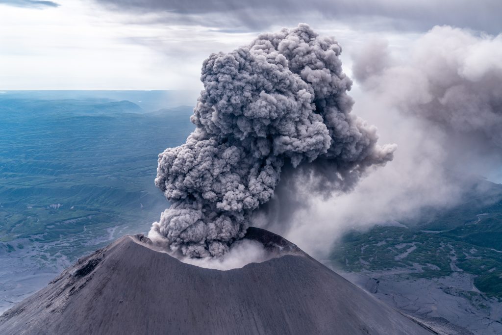
Ten Percent of Earth’s Population Lives in Volcano Shadow
Approximately 800 million people worldwide live within range of potential volcanic hazards, making early detection of eruptions a matter of global public safety. Volcanic eruptions pose immediate dangers, including ejected rocks, toxic gas surges, and pyroclastic flows, to nearby communities. Meanwhile, more distant populations face threats from mudslides, ash falls, and tsunamis triggered by volcanic activity.
Traditional volcanic monitoring relies heavily on the detection of seismic activity and ground deformation measurements, both of which typically occur relatively close to eruption events. By the time conventional monitoring systems register significant changes, evacuation windows may be dangerously narrow for large population centers.
“There are plenty of satellites we can use to do this kind of analysis,” notes Nicole Guinn, a volcanologist at the University of Houston who has studied vegetation changes around Mount Etna in Sicily. Her research represents the first study demonstrating strong correlations between tree leaf coloration and magma-generated carbon dioxide emissions.
Approximately 1,350 potentially active volcanoes exist worldwide, many of which are located in remote or mountainous terrain. This makes traditional ground-based monitoring expensive, labor-intensive, and sometimes physically hazardous for research teams.
Scientists Use Slingshots to Launch Sensors Into Tree Canopies

Ground validation of satellite observations requires creative solutions for accessing forest canopies near active volcanoes. Chapman University researchers have developed an innovative approach using slingshots—sophisticated versions of childhood toys—to deploy carbon dioxide sensors into tree canopies around Costa Rica’s Rincón de la Vieja volcano.
Gregory Goldsmith, a researcher from Chapman University, literally launches monitoring equipment into forest canopies using these specialized slingshots, enabling scientists to measure carbon dioxide concentrations at various heights within the forest ecosystem. Such ground-truth measurements provide essential validation for satellite observations while offering detailed insights into how trees respond to volcanic gas emissions.
During March 2025, scientists participating in the Airborne Validation Unified Experiment deployed spectrometers on research aircraft to analyze the colors of plant life across Panama and Costa Rica. These airborne missions bridge the gap between satellite observations and ground-based measurements, creating comprehensive datasets that improve understanding of tree responses to volcanic activity.
Research teams collect leaf samples directly from trees exposed to elevated carbon dioxide levels, measuring photosynthesis rates and analyzing chemical compositions that reveal how volcanic gases affect plant metabolism and appearance.
Why CO2 Detection From Space Used to Be Nearly Impossible

“Volcanoes emit a lot of carbon dioxide,” explains Robert Bogue, a volcanologist at McGill University, “but there’s so much existing carbon dioxide in the atmosphere that it’s often hard to measure the volcanic carbon dioxide specifically.”
While significant volcanic eruptions produce sufficient carbon dioxide to be detectable from space using instruments like NASA’s Orbiting Carbon Observatory-2, the subtle early-warning emissions that precede significant eruptions remain far below the detection thresholds for direct atmospheric monitoring. “A volcano emitting the modest amounts of carbon dioxide that might presage an eruption isn’t going to show up in satellite imagery,” Bogue adds.
Carbon dioxide background levels in Earth’s atmosphere make distinguishing volcanic emissions from other sources extremely challenging using current technology. Scientists must physically travel to volcanic sites to take direct measurements, a process that becomes prohibitively expensive and dangerous when applied to the roughly 1,350 potentially active volcanoes worldwide.
Many volcanic sites are located in remote areas or challenging mountainous terrain, making it logistically difficult to establish permanent monitoring stations. Scientists needed alternative approaches for monitoring volcanic carbon dioxide emissions that didn’t require constant human presence at dangerous locations.
Success Story: 56,000 People Saved in Philippines

Volcanic carbon dioxide monitoring has already demonstrated life-saving potential through real-world applications. Schwandner led efforts to upgrade monitoring networks at Mayon volcano in the Philippines, incorporating both carbon dioxide and sulfur dioxide sensors into comprehensive early warning systems.
In December 2017, government researchers in the Philippines utilized this enhanced monitoring system to detect signs of an impending eruption at Mayon Volcano. Based on these early warning signals, authorities recommended mass evacuations of surrounding areas. Over 56,000 people were safely relocated before a massive eruption began on January 23, 2018.
As a direct result of the early warning capabilities provided by volcanic gas monitoring, the Mayon eruption resulted in zero casualties despite its significant scale and destructive power. Such success stories demonstrate the life-saving potential of improved volcanic monitoring technologies.
Space-Based Tree Watching Has Serious Limitations

Despite promising applications, vegetation-based volcanic monitoring faces several significant limitations. Many volcanoes exist in climates that don’t support sufficient tree coverage for effective satellite imaging. Desert volcanoes, high-altitude peaks above tree lines, and volcanic islands with sparse vegetation may not provide adequate biological monitoring opportunities.
Fires, changing weather conditions, and plant diseases can complicate the interpretation of satellite vegetation data. Drought conditions can cause trees to appear less healthy, regardless of volcanic activity, while plant diseases may create color changes unrelated to carbon dioxide absorption.
Different tree species respond variably to changing carbon dioxide levels, meaning monitoring approaches must account for local forest compositions and ecological conditions. Seasonal variations in tree appearance also require sophisticated analysis to distinguish volcanic influences from natural cycles.
Multiple Satellites Join the Volcanic Detective Squad

Contemporary volcanic vegetation monitoring employs multiple satellite platforms, including Landsat 8, NASA’s Terra satellite, and the European Space Agency’s Sentinel-2. Each platform offers distinct spectral capabilities and temporal coverage, enabling comprehensive monitoring networks that track vegetation changes across multiple time scales.
Spectrometers deployed on research aircraft analyze subtle color variations in plant life that indicate changing carbon dioxide absorption rates. These airborne instruments provide higher-resolution data than satellite observations while covering larger areas than ground-based measurements.
International cooperation between NASA, the Smithsonian Institution, and universities worldwide creates global monitoring capabilities that could eventually track vegetation changes around hundreds of potentially dangerous volcanoes simultaneously.
Game-Changing Technology Still Needs Silver Bullet Warning
“There’s not one signal from volcanoes that’s a silver bullet,” Schwandner acknowledges. “And tracking the effects of volcanic carbon dioxide on trees will not be a silver bullet. But it will be something that could change the game.”
Vegetation monitoring is one component of comprehensive volcanic warning systems, which also include seismic monitoring, ground deformation measurements, and gas emission tracking. Combined approaches provide multiple independent indicators of volcanic activity, reducing false alarm rates while improving detection sensitivity.
Early detection capabilities could provide weeks or months of warning compared to traditional monitoring methods that typically offer only days or hours of notice before significant eruptions. Such extended warning periods could enable large-scale evacuations and disaster preparation efforts that save thousands of lives.
Scientists continue developing algorithms that automatically analyze satellite vegetation data to identify patterns consistent with increasing volcanic activity. Machine learning approaches could provide continuous global volcanic monitoring with minimal human oversight.
A New Age of Eruption Alerts
Satellite-based vegetation monitoring could revolutionize volcanic hazard management by providing early insights into volcanic activity at remote locations worldwide. Space-based tracking eliminates the need for permanent human presence at dangerous volcanic sites while offering continuous surveillance capabilities.
As satellite technology continues advancing, vegetation monitoring resolution and sensitivity will improve, potentially enabling the detection of even more subtle early warning signals. Future monitoring networks might track hundreds of volcanoes simultaneously, creating global early warning systems that protect millions of people living near volcanic hazards.
The integration of vegetation monitoring with artificial intelligence and machine learning could automate volcanic threat assessment, providing real-time risk analysis that enables emergency management officials to make informed evacuation decisions based on multiple data sources and predictive models.
Featured Image Source: Jeff Schmaltz, MODIS Rapid Response Team, NASA Goddard Space Flight Center