Your cart is currently empty!
Scientists Confirm Earth Has a Hidden Eighth Continent
Most people can name the seven continents without thinking twice. Scientists now say Earth has an eighth, and almost all of it has been hiding underwater the entire time.
Contents
show
The continent is called Zealandia, a massive landmass spread across nearly two million square miles beneath the southwest Pacific Ocean. Around 95 percent of it sits underwater, which explains why it remained one of geology’s biggest debates for decades.
Now, after years of mapping, rock analysis, and magnetic imaging, researchers say the case is finally settled.
The Lost Continent Hidden Beneath New Zealand
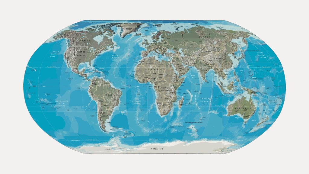
Zealandia stretches across roughly five million square kilometers of the Pacific Ocean. Most of it lies submerged beneath the waves, with New Zealand and New Caledonia forming the few visible pieces above sea level.
Scientists have known for years that the region contained unusually thick crust compared to the surrounding ocean floor. The bigger question was whether it counted as a true continent or simply a collection of scattered continental fragments.
Recent geological work changed that.
Researchers combined rock dating, magnetic mapping, and tectonic analysis to show that Zealandia is one continuous continental structure. The crust shares the same characteristics seen in recognized continents around the world.
That includes:
- Thick continental crust rather than thin oceanic crust
- Distinct geological boundaries
- Ancient igneous, metamorphic, and sedimentary rocks
- A large, coherent landmass connected beneath the seafloor
- A separate tectonic history from nearby continents
Those findings pushed many geologists to formally recognize Zealandia as a continent in its own right.
Zealandia Broke Away From Gondwana Millions Of Years Ago
The story of Zealandia begins more than 100 million years ago when Earth’s continents looked very different.
At the time, much of the Southern Hemisphere formed part of the supercontinent Gondwana. Present-day Antarctica, Australia, South America, Africa, India, and Zealandia were all connected.
Geologists believe tectonic forces slowly stretched and thinned Zealandia’s crust over millions of years.
Around 85 million years ago, the landmass finally split away.
The problem was that Zealandia’s crust became so thin during the breakup that most of it eventually sank beneath the ocean. Unlike other continents that remained elevated above sea level, Zealandia gradually submerged during the Paleogene period as the stretched crust cooled.
Today, only a tiny portion remains visible.
New Zealand’s mountains are actually the peaks of this hidden continent. Several smaller Pacific islands also sit along the exposed edges of the submerged landmass.
Scientists Used Rock Samples To Rebuild A Buried World
One reason Zealandia remained difficult to understand is simple: scientists could not easily reach it.
Most of the continent sits thousands of feet below the ocean surface. Researchers had to rely on dredging missions, underwater mapping, seismic imaging, and rock analysis to piece together its history.
Recent studies focused heavily on North Zealandia, a vast submerged region extending around New Zealand and New Caledonia.
Teams collected volcanic rocks, sandstone, granite fragments, and ancient sediments from underwater ridges deep in the Pacific.
Those samples revealed evidence of a long geological history stretching back hundreds of millions of years.
Researchers discovered traces of ancient volcanic arcs, continental crust, and tectonic activity similar to what geologists see on other major continents.
Some sandstone samples even contained zircon crystals dating back more than one billion years.
That matters because zircon crystals act like geological time capsules.
Scientists use them to determine the age and origin of ancient rocks. The zircon evidence helped confirm that Zealandia formed from continental crust linked to Gondwana rather than younger oceanic crust created beneath the sea.
The discovery also helped researchers reconstruct how Zealandia evolved over time.
Why Zealandia Stayed Hidden For So Long
The idea of a lost continent sounds dramatic, but the reasons Zealandia escaped recognition are surprisingly practical.
Most continents are easy to identify because they sit above sea level. Zealandia does not.
Roughly 95 percent of the continent lies underwater.
That made the region harder to study and easy to overlook for much of modern geological history. Earlier scientists often treated the submerged plateaus and ridges as isolated fragments instead of parts of one connected continent.
The technology needed to map the seafloor in detail also arrived relatively recently.
Modern seismic imaging, gravity mapping, and magnetic field analysis finally allowed researchers to visualize the hidden crust beneath the Pacific Ocean.
One of the biggest breakthroughs came from large-scale magnetic mapping.
Scientists identified long, continuous geological structures stretching across the submerged region. These magnetic signatures showed Zealandia behaved like a coherent continent rather than scattered underwater debris.
Researchers also found evidence of ancient tectonic belts, volcanic arcs, and sedimentary basins extending across the hidden landmass.
Taken together, the findings painted a much clearer picture.
Zealandia Could Change How Scientists Understand Continents

The discovery matters for more than just maps.
Geologists say Zealandia offers a rare opportunity to study how continents form, stretch, fracture, and sink over time.
Because much of the continent remained relatively undisturbed underwater for millions of years, it acts like a preserved geological archive.
On dry land, erosion, vegetation, cities, and human activity can erase huge parts of Earth’s ancient history.
Zealandia stayed hidden beneath the ocean, protecting much of its structure.
Researchers now believe the continent could help answer major questions about plate tectonics and continental breakup.
Several important mysteries remain.
How Did Zealandia Sink?
Scientists know Zealandia stretched and thinned as it separated from Gondwana, but the exact mechanisms behind its dramatic sinking are still debated.
Some researchers believe widespread crustal thinning weakened the continent enough to allow it to submerge.
Others point to deeper mantle processes beneath the crust that may have contributed to the collapse.
Understanding that process could help scientists explain other vanished continental fragments around the world.

What Ancient Ecosystems Existed There?
Zealandia was not always underwater.
Large parts of the continent once stood above sea level before sinking beneath the Pacific.
That raises major questions about the plants, animals, and ecosystems that may have existed there during the age of dinosaurs.
Scientists have already discovered fossil evidence suggesting ancient forests and terrestrial environments once covered parts of Zealandia.
Further exploration could reveal much more.
Could Other Hidden Continents Exist?
Zealandia has changed how scientists think about continental boundaries.
For decades, many geologists assumed the major continents were already fully understood.
The recognition of a mostly submerged continent suggests Earth may still hold geological surprises beneath the oceans.
Researchers have also studied other partially submerged continental fragments scattered around the globe, though none appear as large or coherent as Zealandia.
New Maps Revealed The Full Scale Of The Continent
One of the most important developments came when researchers published detailed geological maps of Zealandia.
The maps combined decades of rock sampling, seismic surveys, gravity measurements, and magnetic imaging.
For the first time, scientists could trace major geological structures across nearly the entire hidden continent.
The mapping effort revealed underwater mountain chains, ancient volcanic regions, sedimentary basins, and tectonic fault systems spread across the Pacific.
Researchers also identified evidence of long-extinct volcanic arcs formed during ancient subduction events.
Some of the structures closely matched geological formations found in New Zealand itself.
That connection helped reinforce the argument that Zealandia is not just a flooded collection of islands.
It is a single continental system with a shared geological history.
The maps also highlighted how enormous Zealandia really is.
At around five million square kilometers, the continent covers an area roughly two-thirds the size of Australia.
That makes it larger than India and significantly bigger than Greenland.

Zealandia Is Already Changing Textbooks
The idea of an eighth continent still sounds strange to many people because school maps have shown the same seven continents for generations.
But geological definitions do not depend on what is visible above sea level.
They depend on the structure and composition of the crust itself.
That distinction is important.
Oceanic crust is typically thinner, denser, and younger than continental crust. Zealandia matches the characteristics of continental crust even though most of it sits beneath the ocean.
Scientists now widely describe Zealandia as Earth’s youngest, thinnest, and most submerged continent.
The recognition of Zealandia has already influenced geological models used to study tectonic movement across the Pacific region.
It may also reshape how researchers interpret ancient climate patterns and biological migration routes tied to Gondwana.
The continent’s existence could even help explain the unusual distribution of certain species found in New Zealand and nearby islands.
Some scientists believe Zealandia once acted as a biological bridge before much of it disappeared underwater.
Why The Discovery Captivated The Internet

Few scientific discoveries capture public attention like the idea of a hidden continent.
Part of the fascination comes from how impossible it sounds.
Most people assume Earth has already been fully mapped.
The idea that a continent larger than India remained mostly overlooked beneath the Pacific Ocean feels closer to science fiction than geology.
Online discussions quickly compared Zealandia to Atlantis, though scientists stress the similarities end there.
Zealandia is not a mythical lost civilization.
It is a real geological continent formed through plate tectonics over tens of millions of years.
Still, the comparison shows why the story spread so quickly.
The discovery combines several things people naturally find compelling:
- Hidden worlds beneath the ocean
- Ancient geological history
- Massive scientific mapping projects
- A continent most people never learned about in school
- New technology revealing unseen parts of Earth
The images released alongside the research also helped fuel interest.
Detailed topographic maps revealed enormous underwater plateaus, ridges, and mountain systems hidden beneath the Pacific.
Some areas looked almost like drowned versions of familiar continental landscapes.
Zealandia May Be One Of Earth’s Best Geological Laboratories

Scientists say Zealandia offers something increasingly rare: a relatively preserved record of continental evolution.
Because so much of the continent remained underwater for millions of years, large parts escaped the erosion and reshaping that altered many other continents.
That gives researchers an unusual opportunity to study geological processes in remarkable detail.
The submerged continent contains evidence of:
- Ancient subduction zones
- Continental rifting
- Volcanic activity
- Tectonic stretching
- Crustal thinning
- Sedimentary basin formation
Each layer helps scientists reconstruct how Earth’s surface evolved over deep time.
Researchers believe Zealandia could become one of the most important regions for understanding the breakup of supercontinents.
It may also improve computer models used to predict tectonic movement and seismic activity.
That has practical value in a region already shaped by earthquakes and volcanic activity.
New Zealand sits directly along the boundary between the Pacific and Australian tectonic plates, making it one of the most geologically active places on Earth.
Understanding the continent beneath it could eventually improve scientists’ understanding of those forces.
Earth Still Holds Huge Secrets Beneath The Oceans
Zealandia is a reminder that humans have explored far more of the Moon’s surface than Earth’s deep oceans.
The Pacific still hides enormous stretches of poorly mapped terrain.
Scientists continue to discover underwater mountains, volcanic systems, deep-sea ecosystems, and ancient geological structures that remained invisible for most of human history.
The recognition of Zealandia shows how much of Earth’s story is still incomplete.
For decades, the continent existed in scientific uncertainty because researchers lacked the tools to fully understand it.
Now, advances in ocean mapping, seismic imaging, and geological analysis are revealing parts of the planet that once seemed unreachable.
Zealandia did not suddenly appear.
It was there the entire time, stretched beneath the Pacific Ocean while generations of people looked at maps that never showed it.
That may be the most surprising part of the discovery.
Earth still has places capable of changing how humans understand the planet itself.