Your cart is currently empty!
Scientists Discover Sea Levels Are Higher Than Previously Thought
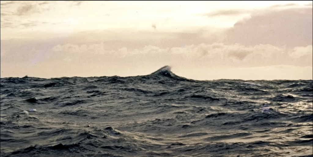
Rising seas are often described as one of the most visible signals of a warming planet. Coastal cities are preparing for stronger storm surges, governments are investing in sea walls, and scientists are working to refine predictions about how oceans will behave in the decades ahead. Yet a new body of research suggests that the global conversation about sea level rise may have been built on a critical misunderstanding.
Contents
show
According to a major study published in the journal Nature, the oceans along many coastlines are already higher than scientists previously believed. On average, coastal sea levels appear to be about a foot higher than earlier assessments suggested, with some regions showing differences of several feet. The discovery does not change the long term projections of sea level rise caused by climate change, but it does change the starting point. And that starting point matters.
The implications are serious. If the ocean is already closer to coastal land than models assumed, then flooding, erosion, and other climate related impacts could arrive sooner than expected for millions of people. The new findings highlight how subtle methodological issues in scientific measurements can ripple outward to influence policy, planning, and public understanding.
A Discovery That Challenges Long Held Assumptions
The research grew out of a simple but puzzling observation. While studying coastal land subsidence in the Mekong Delta in Vietnam, researcher Philip Minderhoud noticed that the water level did not align with what maps and scientific models suggested it should be. The sea appeared higher than expected.
That observation eventually led to a large international analysis examining hundreds of scientific studies on sea level and coastal hazards. Researchers reviewed 385 peer reviewed publications produced over the last fifteen years. What they found was striking. Nearly ninety percent of those studies relied primarily on theoretical models rather than direct measurements of real sea level conditions.
This reliance on models created what the researchers described as a methodological blind spot. The models often used a simplified reference surface known as a geoid, which estimates global sea level based on the Earth’s gravitational field and rotation. For many purposes the approach works well. But when scientists try to understand what is happening exactly where land meets ocean, the geoid alone does not capture the full picture.

The ocean surface is not perfectly smooth or static. Winds, tides, ocean currents, temperature changes, and even variations in salt content constantly push water around the planet. These forces create local variations in sea surface height that can differ significantly from the geoid model.
When studies ignore those variations, they effectively assume that the ocean surface sits at a universal zero point everywhere. In reality, that assumption can be far from accurate. The new analysis suggests that coastal sea levels around the world are, on average, about one foot higher than the baseline used in many studies. In some areas, particularly in Southeast Asia and parts of the Pacific, the difference can reach three feet or more.
For scientists accustomed to working with precise measurements, the scale of the discrepancy came as a surprise. Some experts who reviewed the findings described the results as a wake up call that the scientific community needs to rethink how coastal data is handled.
Why Measuring Sea Level is More Complicated Than It Seems

At first glance, measuring sea level might appear straightforward. Satellites observe the ocean from space, tide gauges monitor local water levels, and digital elevation models map the height of land surfaces. But integrating all these data sources into a consistent picture is far more complex than it appears.
One key challenge lies in the way land and sea elevations are referenced. Land elevation data often relies on digital elevation models derived from satellites. These models measure the height of terrain relative to a geoid. Meanwhile, actual sea surface height varies depending on regional ocean dynamics.
To accurately determine how high a coastline sits above the water, scientists must align land elevation with real sea level measurements using a shared reference system. That step, known as vertical datum conversion, ensures that both datasets are speaking the same mathematical language.
The Nature study found that this crucial step was frequently overlooked. In many cases, researchers simply assumed that the geoid used in elevation data matched the real ocean surface. The result was a systematic underestimation of how high the water actually stands along coastlines.
The problem becomes even more pronounced in regions where ocean dynamics are particularly active. Winds can pile water against coastlines, large scale circulation patterns can raise or lower sea surfaces, and climate cycles such as El Niño can temporarily alter regional sea levels. Over time these factors create persistent differences between the theoretical geoid and the actual ocean surface.
Another complication comes from the quality of available elevation data. High resolution measurements collected using airborne laser scanning exist for some parts of the world, especially in wealthier countries. However, much of the global coastline relies on satellite based datasets that can contain vertical errors of several meters.
These uncertainties matter greatly in low lying regions such as river deltas and coastal plains, where even small differences in elevation can determine whether land remains dry or becomes vulnerable to flooding.
What the Corrected Numbers Mean for Coastal Communities

When researchers recalculated coastal exposure using corrected sea level baselines, the results changed significantly. If global sea level were to rise by about one meter, roughly three feet, the amount of land projected to fall below sea level could increase by up to thirty seven percent compared with earlier estimates.
That difference translates into millions of additional people living in areas that could face severe flooding risks. The study estimates that between seventy seven million and one hundred thirty two million more people could be affected worldwide under a one meter sea level rise scenario.
The impact is particularly pronounced in parts of the Global South. Southeast Asia, with its densely populated river deltas and low elevation coastlines, shows some of the largest discrepancies between assumed and measured sea levels. Countries such as Vietnam, Indonesia, and the Philippines already face serious threats from coastal flooding, storm surges, and land subsidence.
Small island nations across the Pacific also appear especially vulnerable. In these regions, the ocean can already sit higher than models predicted, leaving communities with less buffer against rising tides.
For people living in such places, the findings confirm experiences they have already witnessed firsthand. On the Pacific island nation of Vanuatu, young climate activist Vepaiamele Trief has watched shorelines retreat within her lifetime. Beaches have eroded, coastal trees have toppled into the sea, and infrastructure such as roads has been forced inland as the ocean advances.
Stories like these illustrate that sea level rise is not only a scientific measurement. It is also a lived reality for communities whose homes, cultural heritage sites, and economic livelihoods depend on stable coastlines.
What the Research Means for Climate Science and Planning

It is important to understand what the new findings do and do not change about climate science. The study does not alter projections for how much global sea level is expected to rise over the coming decades. Those projections remain based on well established processes such as melting glaciers, expanding ocean water as it warms, and ice sheet loss from Greenland and Antarctica.
Instead, the research changes the baseline from which those projections are measured. If the ocean already stands higher relative to land than scientists believed, then the thresholds at which flooding and coastal impacts occur could be reached sooner.
This shift has practical implications for urban planners, governments, and disaster preparedness agencies. Coastal infrastructure projects such as sea walls, drainage systems, and evacuation routes are often designed using risk assessments derived from scientific studies. If those studies underestimated present day sea level, the safety margins built into planning decisions could be smaller than expected.
At the same time, some scientists emphasize that local authorities often possess detailed knowledge of their own coastlines. Tide gauge records, regional surveys, and historical experience frequently inform planning decisions. As a result, the methodological issues identified in the study may not always translate directly into real world miscalculations.
Even so, the findings highlight the importance of improving the quality and transparency of coastal research. The study revealed that documentation of vertical reference systems and sea level alignment was often incomplete or entirely absent in published papers. Such gaps make it difficult for other researchers to reproduce results or verify the accuracy of underlying methods.
Researchers involved in the analysis have suggested several solutions. Data providers could supply elevation datasets that are already aligned with measured sea level, reducing the chance of conversion errors. Scientific journals could introduce clearer guidelines requiring authors to document how elevation and sea level data are combined. Peer reviewers could also pay closer attention to these technical details during the publication process.
Together, these changes could help prevent similar methodological blind spots from spreading through the scientific literature.
The Human Dimension of Rising Seas
Behind every statistic about sea level rise lies a human story. Coastal zones are home to a large share of the world’s population. Major cities including Shanghai, Mumbai, Jakarta, New York, and Lagos sit only a few meters above the ocean. Beyond cities, vast agricultural regions such as the Mekong Delta and the Nile Delta support millions of farmers and serve as key food producing areas.
In these landscapes, even modest shifts in sea level can disrupt daily life. Saltwater intrusion can contaminate freshwater supplies and agricultural soils. Frequent flooding can damage homes and infrastructure. Coastal erosion can erase beaches and threaten cultural heritage sites.
The new research suggests that many of these pressures could intensify sooner than previously expected. If the ocean is already closer to coastal land than models assumed, communities may have less time to prepare for future changes.
Climate advocates often stress that the consequences of sea level rise are unevenly distributed. Wealthier nations may have greater resources to build protective infrastructure or relocate vulnerable populations. Meanwhile, smaller or less affluent countries may struggle to finance large scale adaptation projects.
This imbalance is particularly visible in small island states, where rising seas can threaten entire national territories. For residents of low lying atolls, the question is not only how to manage coastal flooding but also how to preserve cultural identity and sovereignty in the face of long term environmental change.
The research therefore reinforces a broader truth about climate change. Scientific measurements and technical models are essential for understanding global trends, but their significance ultimately lies in how they affect real communities.
Improving Our Understanding of the Ocean

The discovery that many coastal studies underestimated baseline sea level does not invalidate decades of climate research. Instead, it highlights how science evolves as new data and improved methods become available.
Advances in satellite technology, ocean monitoring systems, and high resolution mapping are already providing more detailed insights into how coastlines function. New missions capable of measuring ocean surface height with centimeter level precision are expanding scientists’ ability to observe regional sea level patterns.
Future research is likely to focus on integrating these datasets more effectively. Scientists are increasingly exploring approaches that combine satellite observations, oceanographic measurements, and land elevation data within unified frameworks. Such integration could produce more reliable projections of coastal risk.
Another promising area of study involves vertical land motion. In many coastal regions the land itself is sinking due to natural geological processes or human activities such as groundwater extraction. When land subsides while sea levels rise, the combined effect can dramatically increase flood risk.
By accounting for both ocean dynamics and land movement, researchers hope to develop a more complete picture of how coastlines will evolve during the twenty first century.
For policymakers and communities, the message is both cautionary and constructive. The caution lies in recognizing that earlier estimates may have underestimated how close the ocean already stands to many coastlines. The constructive element lies in the fact that improved measurements now offer an opportunity to refine adaptation strategies before the most severe impacts unfold.
The ocean is constantly changing, shaped by winds, currents, climate patterns, and geological forces. Understanding those changes requires careful measurement and constant reevaluation of assumptions. The recent findings serve as a reminder that even well established scientific methods can contain hidden gaps.
As the world continues to grapple with climate change, refining the accuracy of environmental data will remain essential. Better measurements will not stop the seas from rising, but they can help societies prepare more effectively for the challenges ahead.
In the end, the lesson from this research is simple but powerful. When it comes to understanding our changing planet, the starting point matters. And sometimes, looking more closely at the fundamentals can reveal that the reality on the ground is already different from what we thought.