
Your cart is currently empty!
If You Think It’s Hot Now, Brace for the Super El Niño Heading Our Way
Across the UK, people spent recent days crowding beaches and parks under a sky that felt more like high summer than late spring. For most, the heat was a pleasant surprise. For the scientists tracking ocean temperatures thousands of miles away in the tropical Pacific, it carried a different meaning entirely.
Contents
show
What is forming out there has a name, a documented history, and a track record that includes one of the deadliest disasters humanity has ever recorded. Researchers are unusually confident that a major event is on the way, possibly one strong enough to break records that have stood for nearly 150 years. The heat people are enjoying now may turn out to be the gentlest part of what comes next.
The Ocean Pattern That Reshapes Global Weather
El Niño is a natural, cyclical climate pattern centered on the warming of surface waters in the central and eastern equatorial Pacific. Understanding why it matters requires understanding what it disrupts.
Under normal conditions, trade winds blow westward along the equator, pushing warm water from South America toward Asia. Cold water rises from the depths to replace it through a process called upwelling. El Niño throws that system into disarray. Trade winds weaken, the warm water drifts east toward the Americas instead, and the Pacific jet stream is forced south of its usual position. Upwelling slows or stops entirely, and without nutrients being carried from the ocean depths to the surface, phytoplankton populations collapse off affected coasts. Fish that feed on phytoplankton decline, and everything that depends on those fish follows. Entire marine ecosystems are disrupted, and weather patterns across the planet reorganize as a consequence.
What Separates a Super El Niño From the Rest
Not every El Niño is created equal, and the distinction comes down to water temperature. Standard El Niño conditions begin when sea surface temperatures in a closely watched region of the Pacific exceed 0.5°C above normal for the time of year over a sustained period.
A super El Niño sits in a different category. Mark Roulston, a senior research fellow at Lancaster University’s Crucial lab, explained the threshold. “A ‘Super El Nino’ is often defined as when these temperatures are more than 2C above normal for the time of year, so a more extreme version of the El Nino phenomenon.”
Events that severe are rare. Since the catastrophic one recorded in 1877 and 1878, only a handful have crossed into super territory: 1982 to 1983, 1997 to 1998, and 2015 to 2016. Some forecast data for the developing event suggests temperatures could climb past 3°C above normal, which would exceed the current known peak of 2.7°C set during the 1877 event, though observational tools at that time were far less reliable than what exists today.
The Forecasts Are Growing More Confident
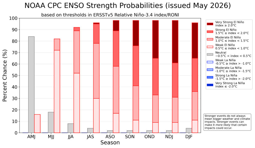
What sets this year apart is the unusual confidence among forecasters, particularly given that spring predictions of El Niño have historically been unreliable. NOAA’s Climate Prediction Center released a forecast in May 2026 placing a 65% chance on the upcoming event being classified as strong or very strong from October onward, a roughly 20 percentage point jump in certainty from its April assessment. NOAA also estimated an 82% chance that El Niño would arrive between now and July.
More than half of the European Centre for Medium Range Weather Forecasts models suggest a temperature increase exceeding 2.5°C by autumn, placing the event firmly within the super range. Australia’s Bureau of Meteorology, which applies a stricter threshold, has confidently shown the possibility of a very strong event developing. Lancaster’s Crucial Lab puts the probability of conditions reaching super status at around 45%.
Adam Scaife, head of long-range prediction at the UK Met Office, summarized the outlook in terms that left little room for hedging. He said there was definitely something coming, that forecasters were very confident about it, and that it looked like a big event, possibly even of record strength. The pace of warming has been striking. Going from the La Niña conditions of last winter to a potentially strong El Niño within a single year is, as NOAA meteorologist Nathaniel Johnson described it, a rare occurrence.
Why 2027 Could Become the Hottest Year Ever Recorded
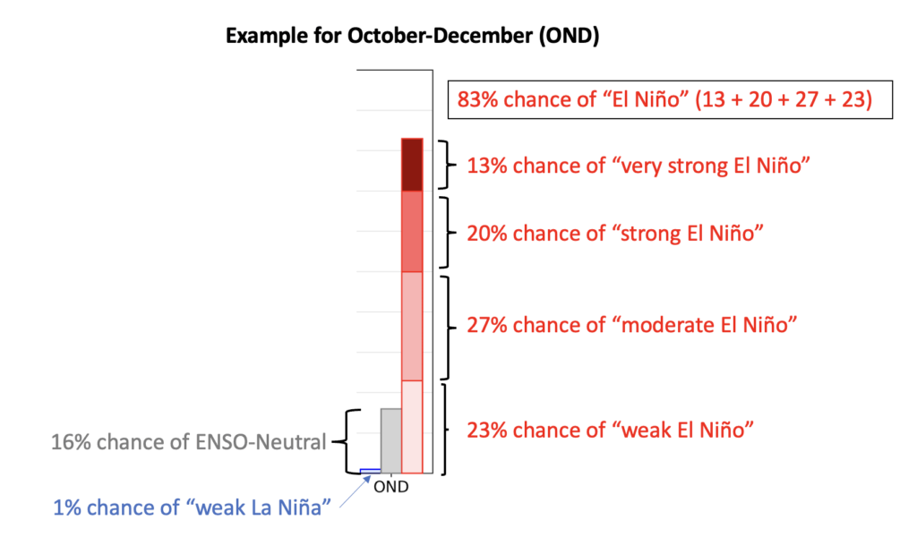
(Image credit: NOAA Climate Prediction Center)
The most immediate consequence of a strong El Niño is its effect on global average temperature, which it typically boosts by around 0.2°C. That increment sits on top of an already warming planet, and the combination has record-breaking potential.
The world’s most recent El Niño, which ran from May 2023 to March 2024, was partially responsible for 2024 becoming the hottest year in 175 years of recorded observations. If the incoming event reaches strong or very strong intensity, 2027 could surpass that record and push global average temperatures permanently past the 1.5°C benchmark above pre-industrial levels established by the Paris Agreement.
Professor Bill McGuire, emeritus professor of geophysical and climate hazards at University College London, expects the event to be severe. He has said he would not be surprised to see temperatures of 40°C or above in the UK, and that the 2.5°C Pacific threshold may be broken with temperatures potentially approaching 3°C, challenging the strongest El Niño on record.
The Disaster Scientists Keep Returning To
The reason researchers invoke 1877 so frequently is that it represents the worst-case version of what a super El Niño can unleash. The event that began that year and ran into 1878 has been described by researchers as arguably the worst environmental disaster ever to befall humanity.
It did not arrive all at once. Drought began spreading across the tropics and subtropics in 1875, and in the years that followed, climate forces in the Indian and Atlantic oceans combined with a record-breaking El Niño to amplify and prolong the dry conditions. The resulting famine killed more than 50 million people across India, China, Brazil, and elsewhere, representing 3 to 4% of the global population at the time. Scaled to today’s population, an equivalent disaster would mean at least 250 million deaths.
Deepti Singh, an associate professor at Washington State University who has studied that super El Niño, has been careful to note that famine is not an automatic consequence of drought. In the 1870s, the deliberate actions of colonialists dismantled local systems that communities had relied on to weather climate variation. Those specific political conditions do not exist in the same form today, but the underlying climate risk has not gone anywhere, and Singh has warned that warmer modern conditions could make the associated extremes more severe than they were 150 years ago.
How a Super El Niño Disrupts the World
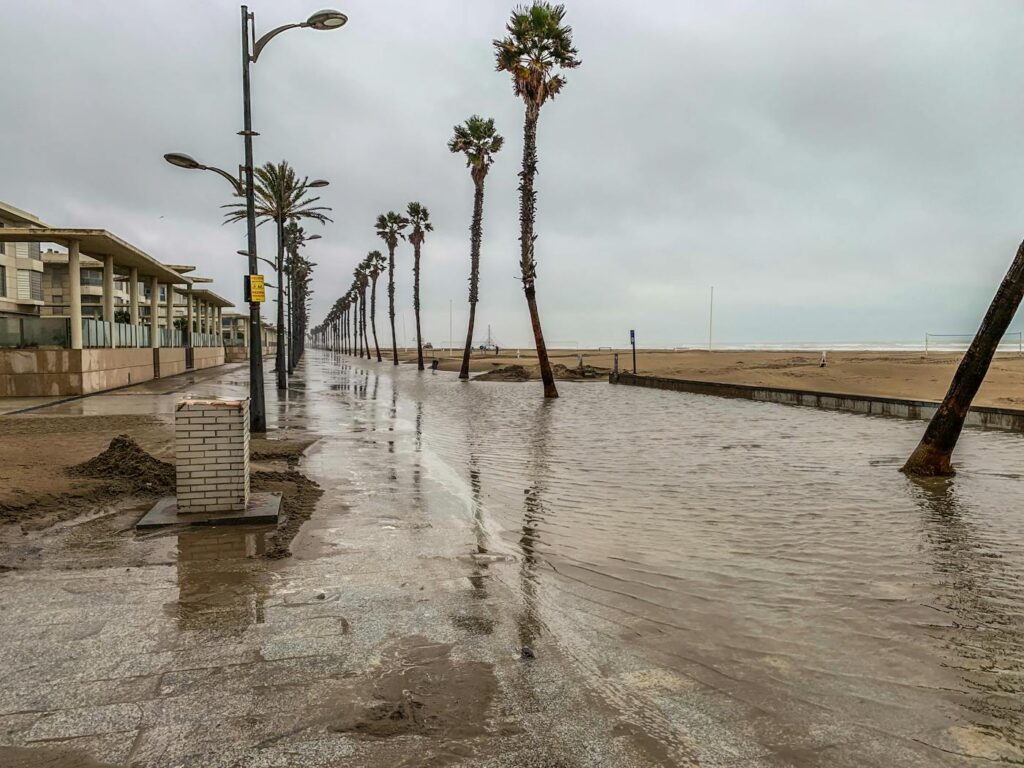
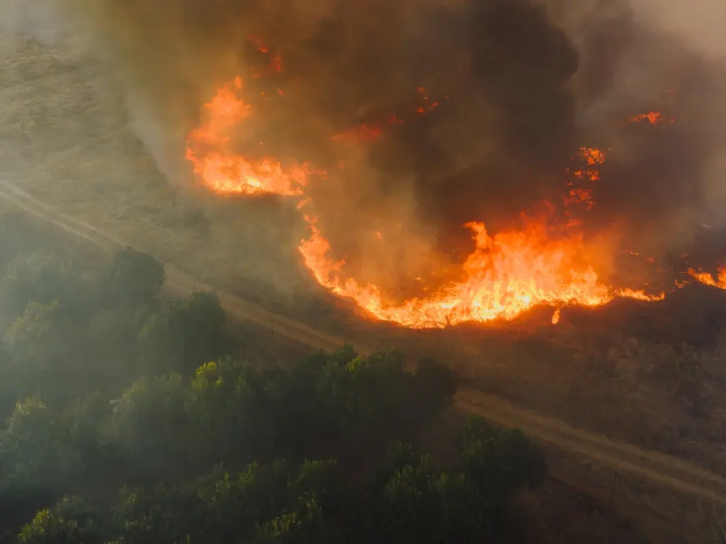
The regional consequences spread across continents. Peru and Ecuador face severe flooding, a pattern that isolated entire communities during the 2017 floods that followed a strong El Niño. Australia, Indonesia, and northern South America face heightened drought and wildfire risk, threatening agricultural output and global food stocks. East Africa and Central Asia see elevated flood probability.
The Atlantic hurricane season typically quiets during El Niño events, and forecasters are already suggesting this year’s season will be calmer than average. That sounds like good news, but as Professor Liz Stephens of the University of Reading has pointed out, a quieter Atlantic means less rainfall for Central America and a corresponding risk of drought. The 1997 to 1998 super El Niño produced estimated global economic losses of between $32 billion and $96 billion, and it killed an estimated 16% of the world’s coral reefs.
Food security sits at the center of the concern, and current geopolitical conditions threaten to amplify it. Stephens connected the climate risk to the broader picture facing vulnerable populations.
“You’ve got more people that are living in poverty already and if you get a reduction in crop yields because of drought or flooding [from El Niño] then that drives prices even higher. So we’re looking at potentially quite huge humanitarian impacts this year, especially if the crisis in the Middle East continues,” she said.
The Statistical Trap That Follows Every Spike
There is a peculiar aftereffect to super El Niño events that has been confusing in the past. Because these events produce such a sharp temperature spike, the years that follow often register as cooler by comparison, even as the underlying warming trend continues upward.
Roulston explained how that pattern has been misused. After the 1997 to 1998 super El Niño, global temperatures did not reach the same level again until 2014, which prompted some to declare that global warming had stopped. Since 2014, temperatures have continued climbing and have surpassed the earlier record. He expects the same misreading to follow the next event, describing it as a statistical illusion created by picking a record year as a baseline rather than any genuine reversal in the warming trend.
A World Far Better Equipped Than in 1877
If there is reassurance to be found, it lies in how much humanity’s ability to anticipate these events has advanced. In 1877, there was no way to know a super El Niño was coming or to understand what it meant. The turning point came after the 1982 to 1983 event, which prompted international collaboration to build real-time ocean monitoring across the Pacific.
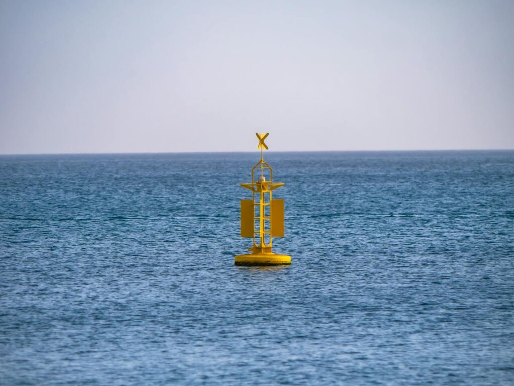
By the mid-1990s, around 70 moored buoys measured winds, air temperatures, humidity, pressure, and ocean salinity. That network has since grown to more than 4,000 instruments providing daily data, enabling scientists to track El Niño as it develops in the remote central Pacific. Seasonal forecasting systems at NOAA and ECMWF have run since 1996, and climate scientist Kevin Trenberth, who helped lead the post-1983 monitoring effort, has described the establishment of real-time tracking as a major achievement.
That foresight changes what is possible. Governments, humanitarian organizations, and agricultural planners can now prepare for what is coming rather than discover it after the damage is done. Singh has emphasized that international collaboration will be vital to reduce the impact on the most vulnerable populations in the countries most at risk.
What is building in the Pacific this year will eventually pass, as super El Niño events tend to be relatively short-lived even within longer cycles. But its effects on temperature, food systems, and ecosystems will extend for years, and it arrives as one more marker on a climate trajectory that scientists say is still accelerating. The heat outside the window right now is not the story. It is the prologue.
climate change, Climate Risk, Climate Science, drought wildfire risk, El Niño 2026, El Niño forecast, ENSO cycle, extreme weather, global food security, Global Warming, hottest year 2027, humanitarian crisis climate, Met Office El Niño, NOAA climate prediction, NOAA forecast, Pacific climate pattern, Pacific Ocean warming, record temperatures, sea surface temperature, Super El Niño, weather forecast 2026